GR10: Our story
Part 1: Calenzana - Castel de Vergio
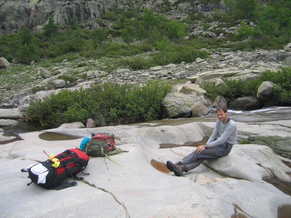
Prologue
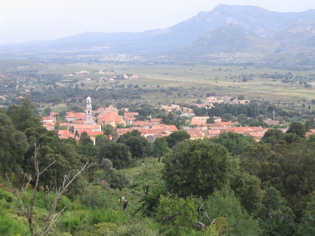
Saturday May 31st at noon we left Doetinchem by car in the direction of Corsica. We drove through Germany and Switzerland to Italy. In Germany we had some severe rainfall. By the time we reach Switzerland the wetter is better. In Switzerland we have pizza for dinner. At midnight we enter Itally. Here hardly make any progress because the nothern part of Itally is one hugh village. So after Milan and along the coast we take the highway, else we would not be in time at the port of Livorno for the boat to Bastia.At 12:45 we leave the boat in Bastia. We drive over the D81, a very curvy road, to Saint Florent and Monetta. From there we continue our way in the direction of Calvi and finally to Calenzana. At the gite Edwin leaves the car together with both backpacks. While he puts up the tent, I drive to Vizzavona. Here I park the car at the railway station and take the train to Ponte Leccia and the bus to Dolce Vita. It is already near ten o'clock when I leave the bus for a walk of 8 km to Calenzana. Next to me also two English men who planned to walk the GR20 leave the bus. Together we walk along the road to Calenzana. It is already past eleven o'clock when we reach our final destination for that day.
Monday June 2nd: Calenzana - refuge d'Ortu di u Piobbu
Statistics:distance: 12 km
up: 1550 m, down: 235 m,
weather: starts sunny, followed by fog and a rain shower.

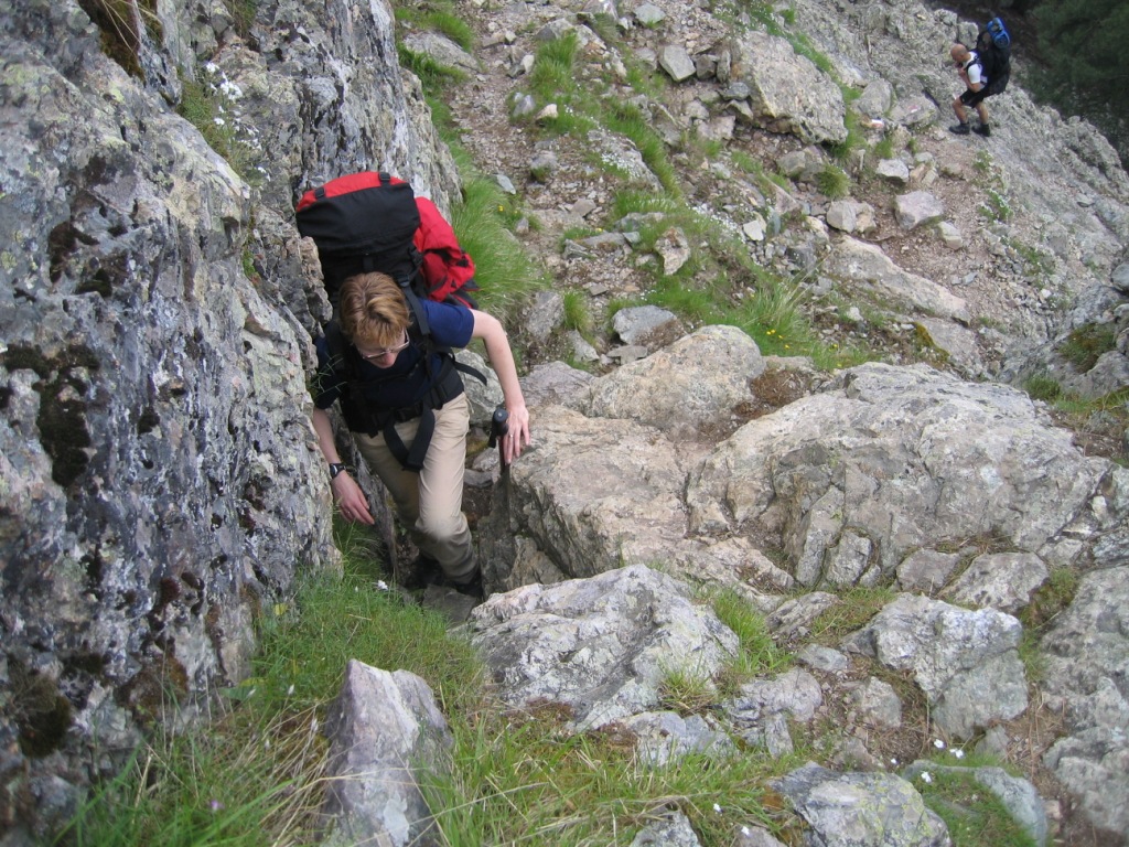
Because I arrived quite late the night before, we take our time this morning. When we open our tent, we see that almost everyone already has left the "campsite". After a good breakfast with porridge made of oatmeal and peanuts we also leave the campsite to start with our GR20-expedition. Directly after the start the route starts to climb. During the climb we see several Helleborus next to the path and the remainings of a dead calf on the path between the trees. Later on the path becomes more rockier, especially between the two cols. Here we have the possiblity to use a steel cable for the first time on the GR20, only it is broken and only 10 cm remains, not much of a help. After the heat of Monday we are glad that it is getting foggy, despite the fact that we have missed some great views. The fog joins us till it starts to rain for a short time just before we reach the refuge. Here we find a nice spot to pitch our tent.
Tuesday June 3rd: refuge d'Ortu di u Piobbu - refuge de Carrozzu
Statistics:distance: 8 km
up: 750 m, down: 1050 m,
weather: starts sunny, followed by fog and ends sunny.


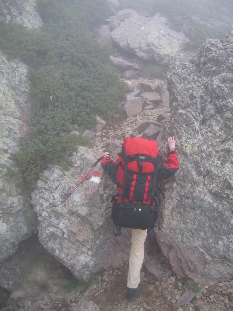
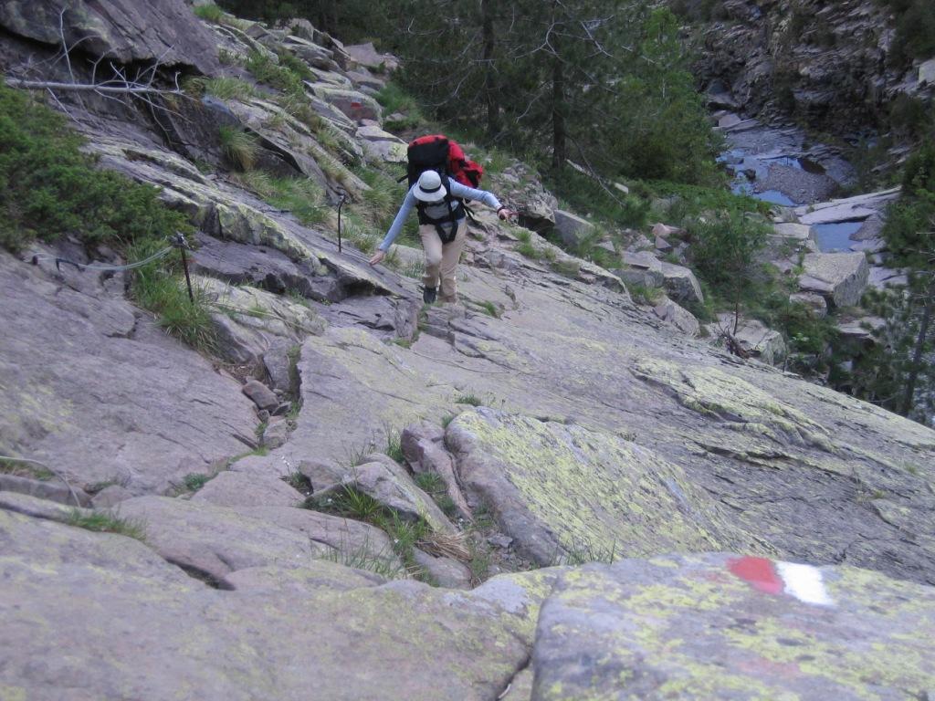
When we leave our campsite at refuge d'Ortu di u Piobbu, the sun is shining. Shortly after leaving the refuge you need to look well for the waymarks. You can easily take the wrong track. The route immidiately starts climbing over smaller and larger blocks. After the ruins of the bergerie the route goes up along huge stones. Just before the col the route is quite steep. After the climb we can enjoy of a spectacular view from la Bocca di Pisciaghja. We see what we have missed during the first day. After the col the clouds start to move in and shortly after that it's getting foggy again. The final descent of the day from la Bocca di L'Innominata is very steep in the beginning but becomes later on more relaxing.
Since the refuge is situated more or less in the forest, there are a lot of ants. So after pitching our tent at a spot that is just a bit to small, we join our dinner on the rocks near the tent. After dinner we enjoy the sun for another while.
Wednesday June 4th: refuge de Carrozzu - refuge d'Asco Stagnu
Statistics:distance: 6 km
up: 860 m, down: 710 m,
weather: starts partly clouded, followed by rain and thunder.

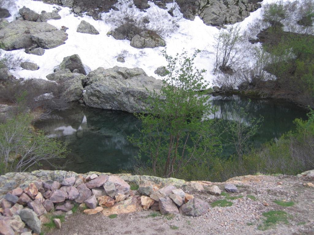
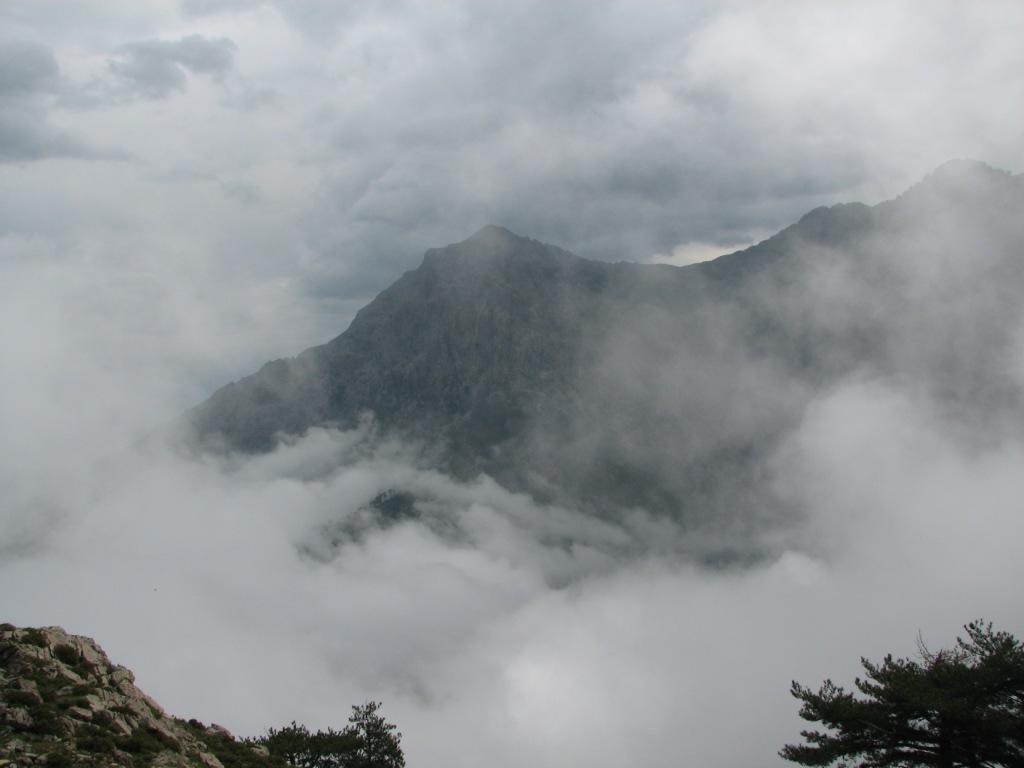
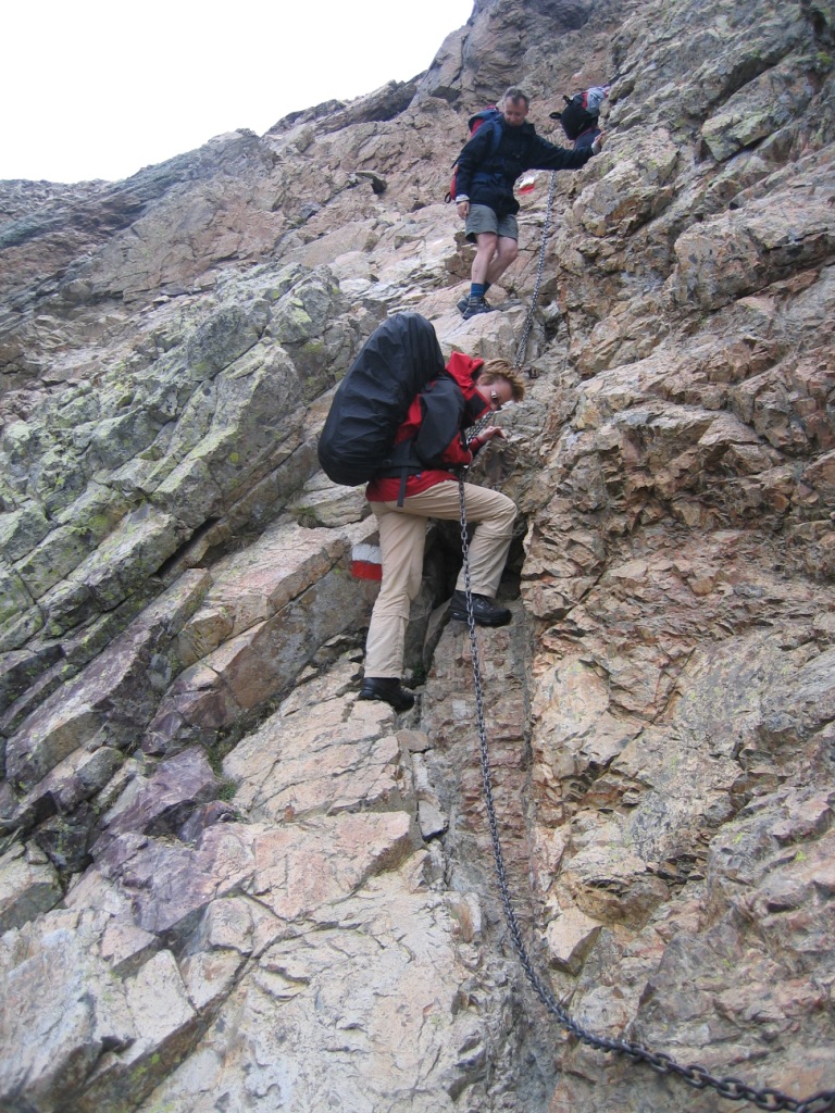
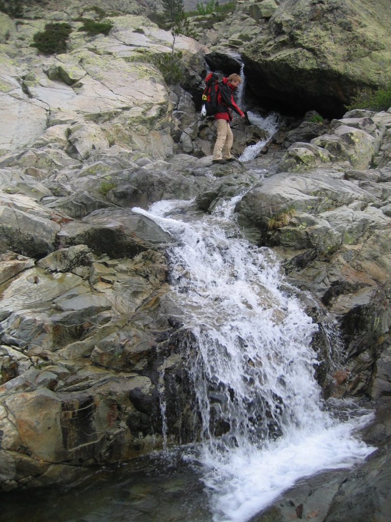
After leaving the campsite the route descends slightly to the suspension bridge that crosses the Spasimata. After the bridge the route seriously starts climbing over huge stones. On the way up we are already hearing the a few thunderclaps in the distance. After lake la Muvrella we walk though the first of many snow fields up to bocca di a Muvrella. We continue along the ridge to Bocca di Stagnu. Here we have some sun, but not for long. Shortly after we have left the col it starts to rain and thunder. We descend slowly, foot by foot and sometimes even on hands and feet. By the time we arrive at Haut Asco we are completely soaked. We pitch our tent on a grassy field near the refuge and go to the refuge to let our clothing dry near the fire.
Thursday June 5th: refuge d'Asco Stagnu - refuge de Tighjettu
Statistics:distance: 8 km
up: 1000 m, down: 755 m,
weather: Dry with low clouds, cold and windy.

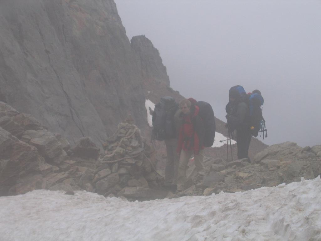

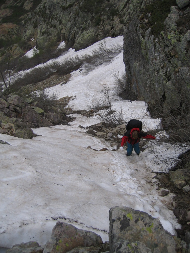
Today is the day of the cirque de la Solitude - the toughest day of the GR20. The climb to Bocca Tumasginesca starts gently, but when you come closer to the col, the path becomes steper, but not too steep. Because of the wind and low temperature we have only a short break at lavu d'Alture. At Bocca Tumasginesca we have enjoyed the view for a short while. Then we start decending carefully into the cirque. During the descent we completely get closed in by the clouds. Luckely, the fog is not so dense that we have to stop. The climb up is long and energy consuming. At Bocca Minuta we finally have our well deserved lunch break. The descent that started rexaling, later on becomes so steep that we needed to use our hands and feet. By the time we arrive at the refuge our feet are hurting of the descent. At the refuge we think to see a nice spot for our tent, but a couple of German fellow hikers tells us that it is the heli platform where we are pitching our tent. So we have to watch out for another spot.
Friday June 6th: refuge de Tighjettu - Castel de Vergio
Statistics:distance: 15 km
up: 850 m, down: 1115 m,
weather: Start sunny, quiet dense fog at higher altitudes, afternoon sunny.
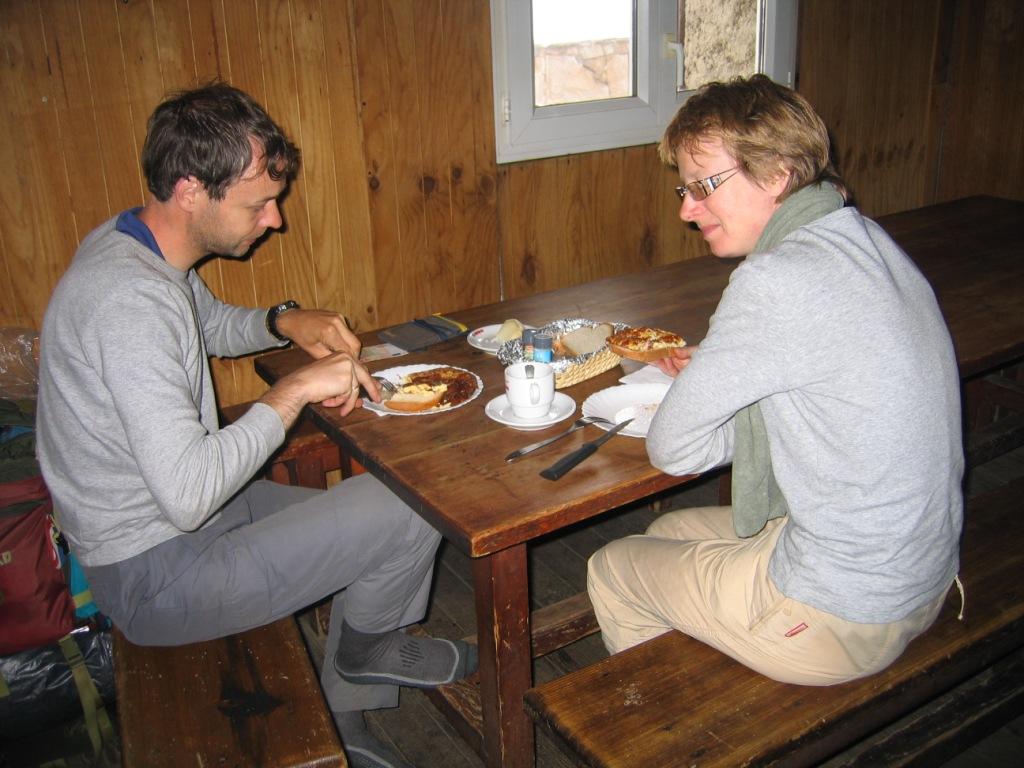
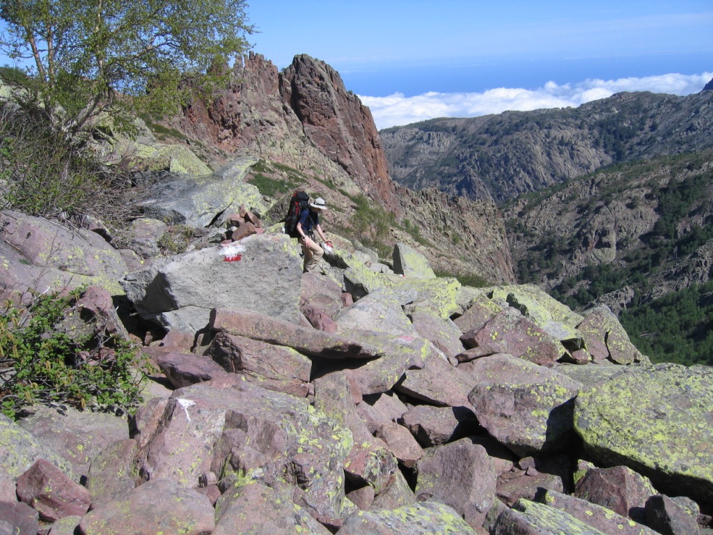
After leaving the refuge the route continues descending towards the bergeries d'U Vallone. Here we notice that it is also possible to camp here and it is a much nicer location than at the refuge. However, yesterday afternoon we were glad that when we arrived at the refuge that we did not have to descend another 40 m that day. After the bergeries the path enters a forest and stays more or less on the same altitude, so we can make some meters. The climb to the col is sometimes quite steep. When we arrive at the col we are surrounded by the clouds. The walk from the col to the refuge takes much longer than the 15 min given in the booklet, because of the distance and the altitude difference to overcome. But finally after 30 minutes the refuge appears out of the fog. At the refuge we have a good lunch with scrambled eggs and bread. After the refuge the route slowly starts to descend. After about an hour the path gets much steper and descends toward the river Golu deep down the valley. The walk along the river is very beautiful. Again we need much more time than given in the booklet. Late in the afternoon we arrive at Castel de Vergio, where we pitch our tent on a nice meadow next to the gite. Here we hear from fellow hikers that they have experienced the same, they also needed more time than the given 6.5 hours and they all found it very tiring.
Continued in part 2

Last modified July 2009