HRP: Our story
Part 2: D934 - Hospital de Vielha
Prologue
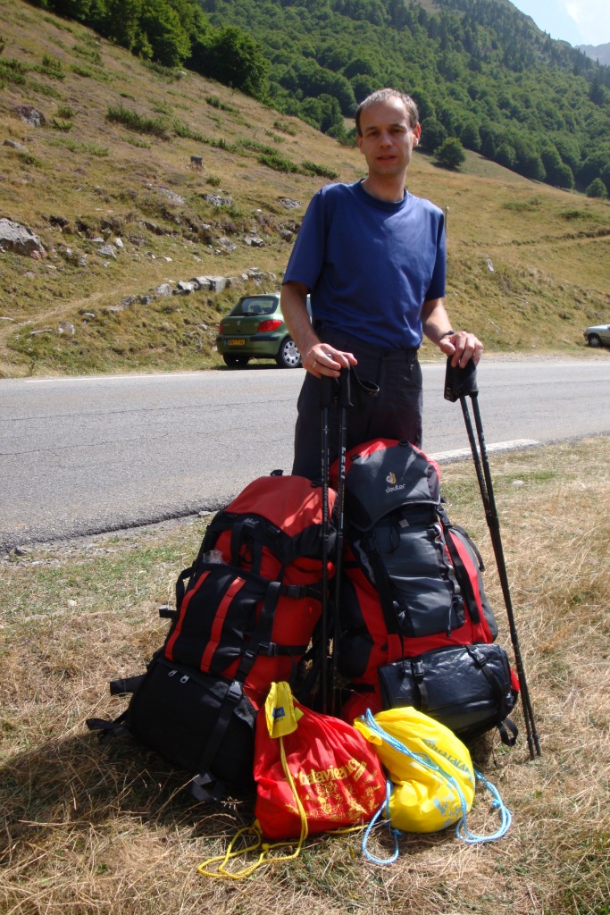

Sunday morning we arrive at the train station of Montréjeau. Because the counter is still closed and our second train is the TGV to Paris, we buy a ticket for the 8:30 train to Tarbes. At the station of Tarbes at the counter, we buy two tickets with reservation for the TGV to Paris, uh no to Pau. At the station of Pau, we take the 12:45 bus to Laruns from there we continue our journey with a sort of local bus to the parking lot where we left the route two years ago.
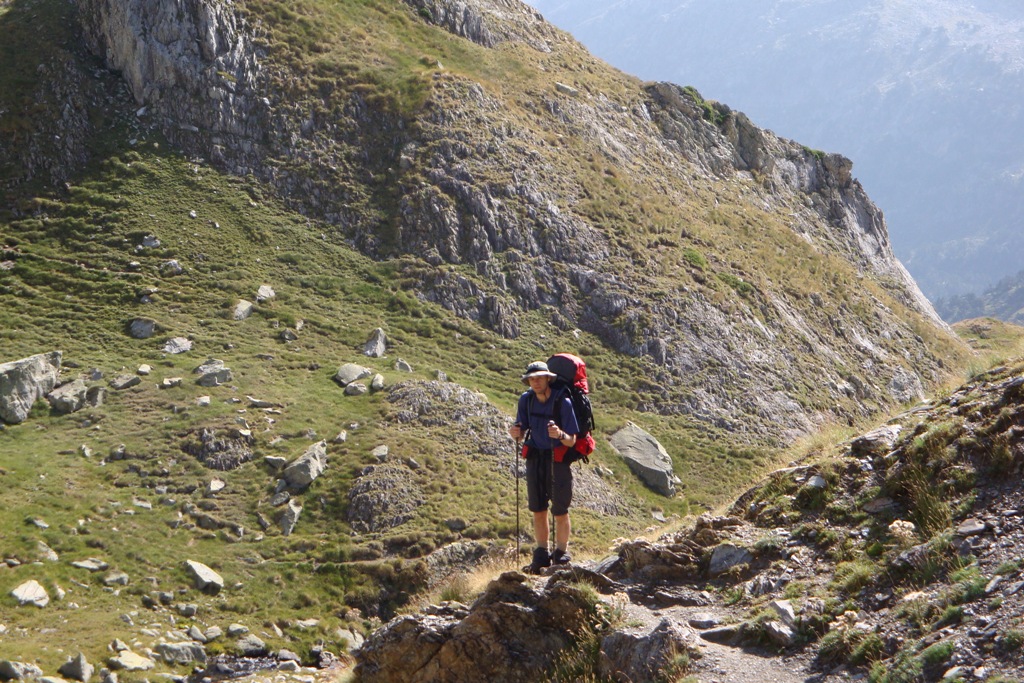
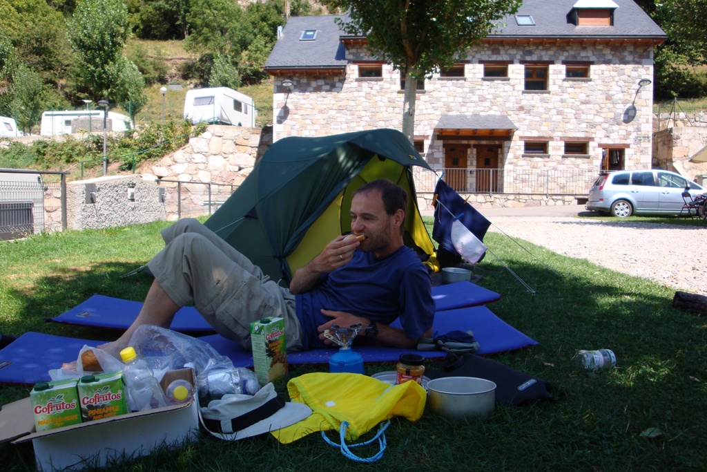
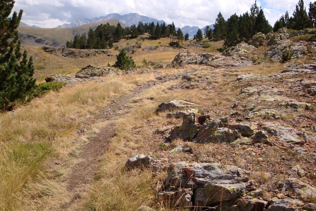
From now on we are going to do it on their own, so backpack on, sticks to the proper height and walk. Because this is actually day 0 of the holiday, we take it easy and walk only one hour until we find a suitable place for the night. From our overnight stay we have a nice view on the Pic du Midi d'Ossau.
Monday August 20th: Ruisseau d'Arrious - Lac de Batcrabère
Statistics:distance: ca 9 km
up: 1000 m, down: 400 m,
weather: sunny, with a small thundershower in the beginning of the afternoon.
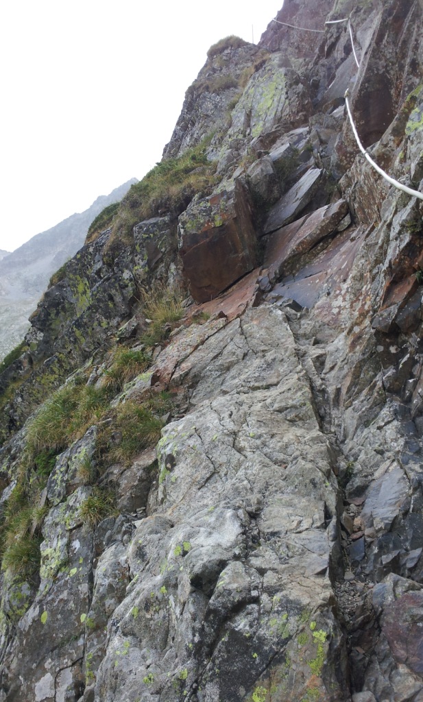

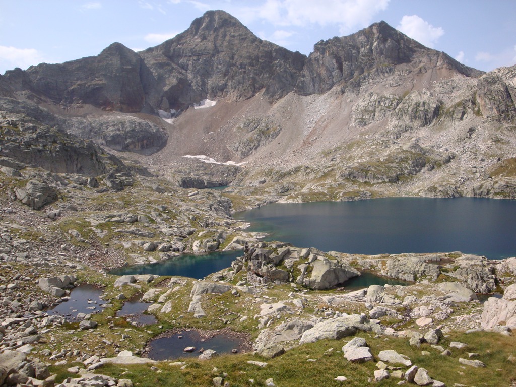

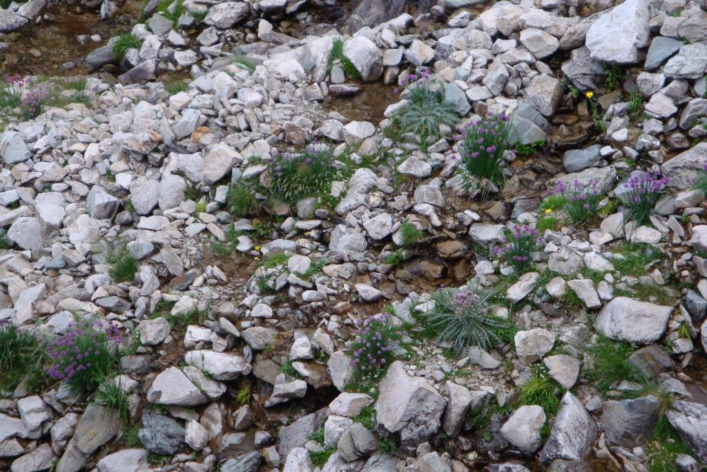
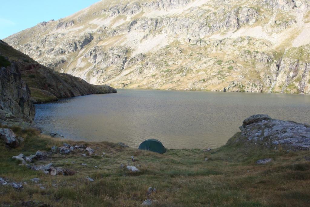
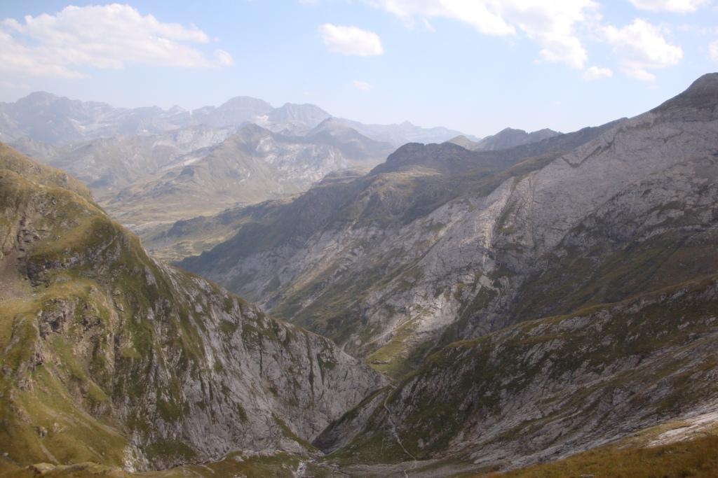
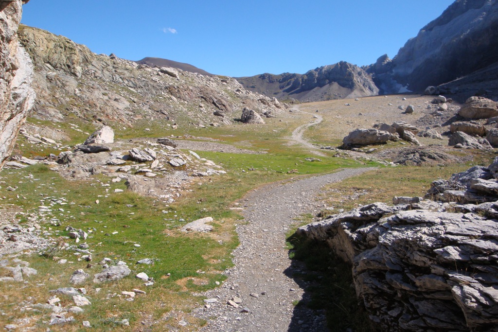
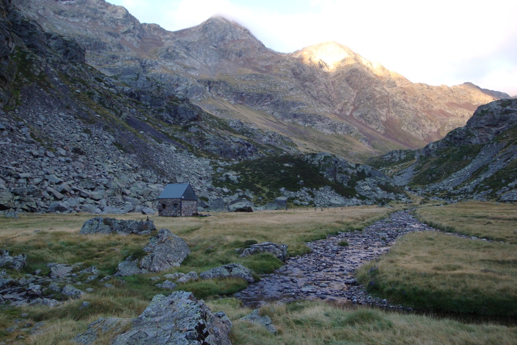
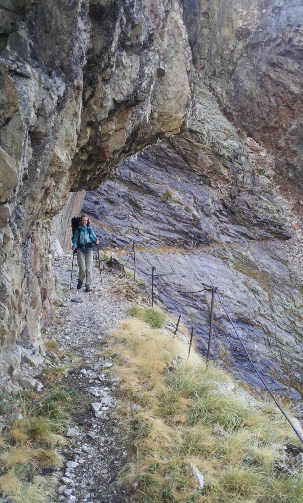
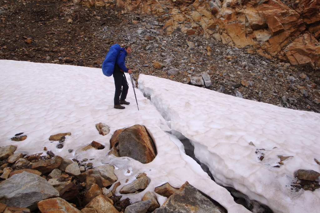
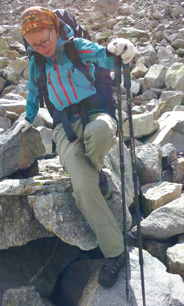
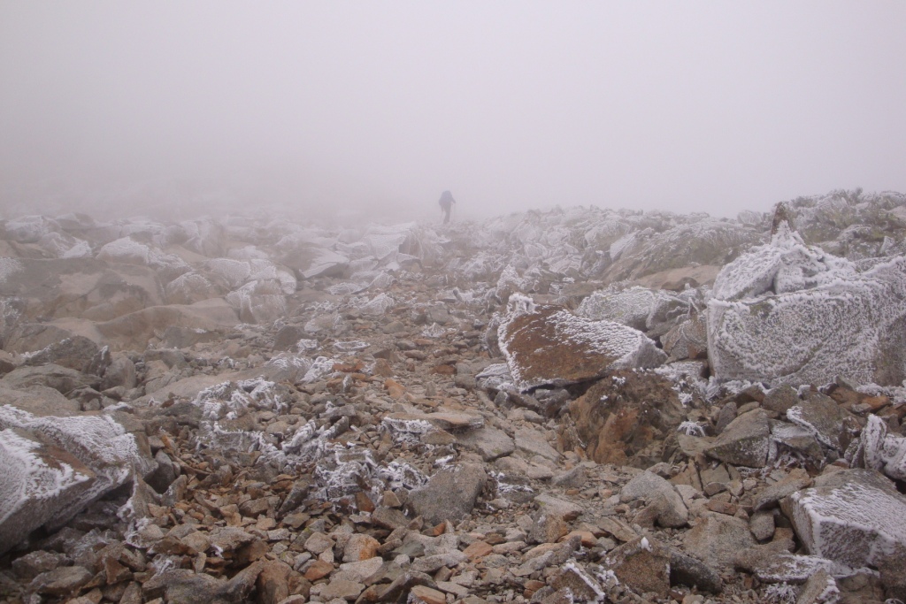
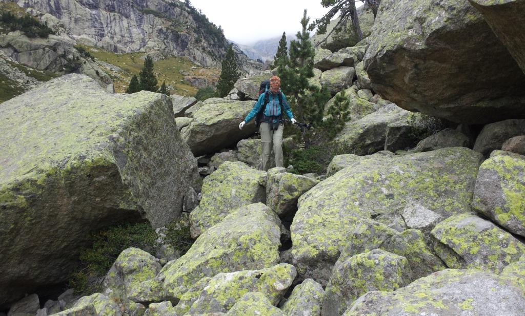
This morning, we have ravioli and tea for breakfast. After breakfast, we pack our backpack, break up the tent and we are back on track and continue climbing towards Col d'Arrious. After a short break we climb to Lac d'Arrious and Passage d'Orteig - a chain secured passage along a cliff. Because we have good weather, is this passage doable despite our heavy backpacks. After the passage we have to descend a little to arrive at refuge d'Arremoulit. After another break we continue to col du Palas. The ground is now less walker friendly - we can indulge our biggest 'hobby' walking over boulders. After the pass we take the wrong path, what we notice when people come our direction from the col where we want to go to are walking on a different 'path'. This error is fortunately recovered quickly, so after some scrambling we arrive at Port du Lavedan after all. After the port follow more rocks. According to the author of the book that we use, the grief should be suffered if we had passed a small lake, well at this point we disagree, the grief just went on. At the height of the first lake of the Lacs de Batcrabère we pitch tent for the night.
Tuesday August 21st: Lac de Batcrabère - Barranco de Campoplano
Statistics:distance: ca 13 km
up: 900 m, down: 750 m,
weather: sunny and warm.
We start the day with porridge and tea, as usual during hiking vacations, then we pack our backpack and we break down the tent. After this we are ready to continue to descend. The first part of the descend up to refuge Larribet is still annoying. After passing the refuge not only the path gradually improved, also the landscape gets a lot friendlier to see. After a break in the shade of cabane de Doumblas, we start with the climb towards Col de la Peyre Port-St-Martin. The climb that is somewhat steeper at first and then very gradually for the major part. During our lunch break, approximately halfway the climb, we decide not to continue to climb to the Col Cambales because that is a difficult climb and descent, according to the description and we just have had a difficult descent. So after Col de la Peyre Port-St-Martin we descend into Spain to an alternative route which passes Embalse de Campoplano and Col de la Fache. On the map this route seems to be easier with more opportunities for camping. We pitch our tent on the other side of the stream, which runs through the valley through which we climb towards Col de la Fache. Often the shade of the surrounding mountains is covering the tent already at the end of the afternoon, but not here, here the sun sets just after half past 8.
Wednesday August 22nd: Barranco de Campoplano - Lac de Arratille
Statistics:distance: ca 10 km
up: 750 m, down: 800 m,
weather: sunny and warm.
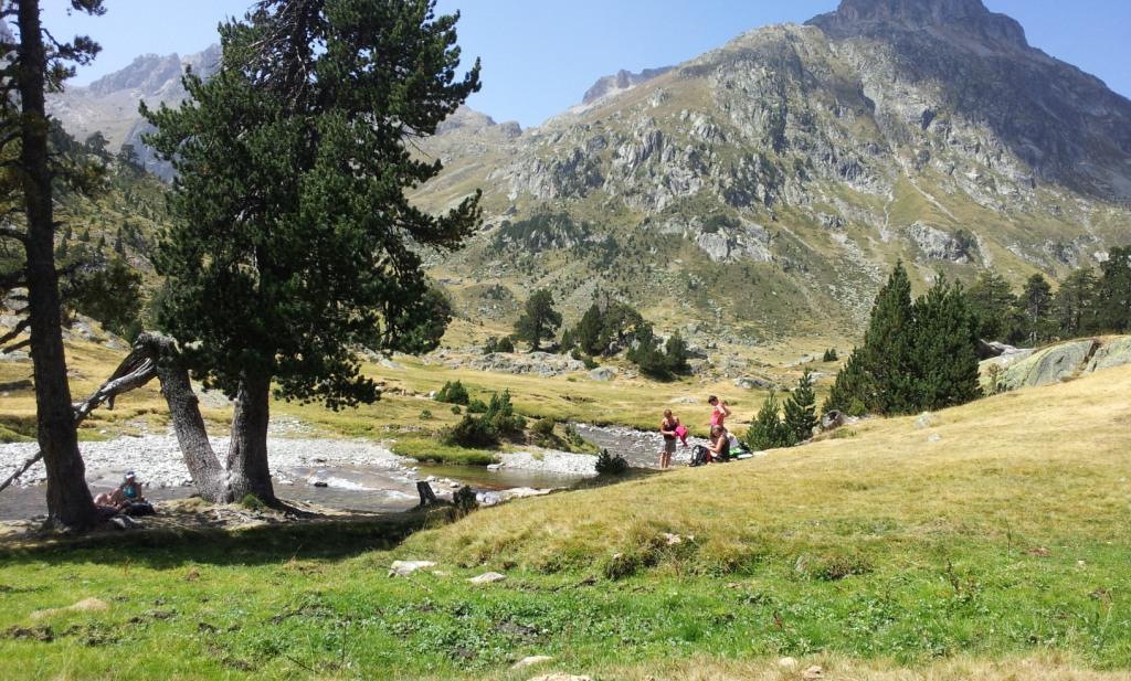
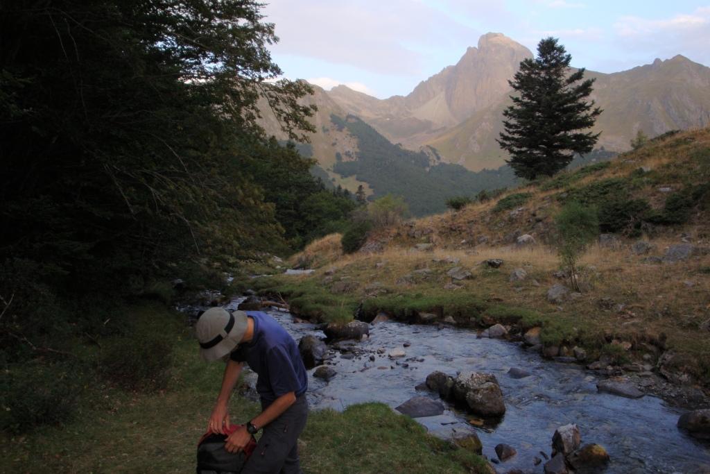
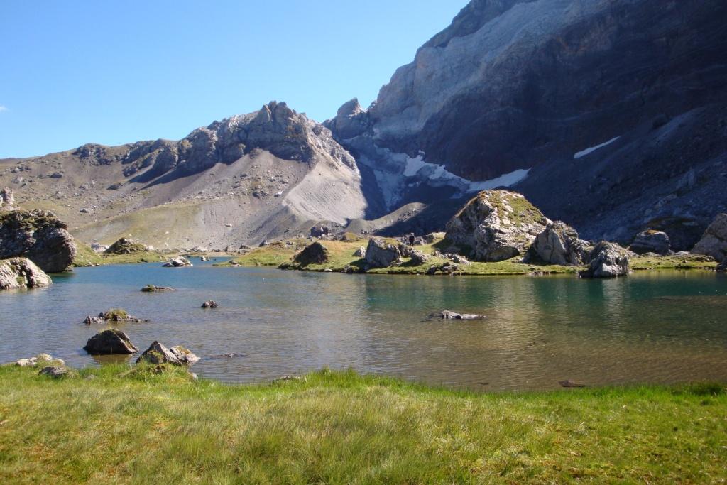
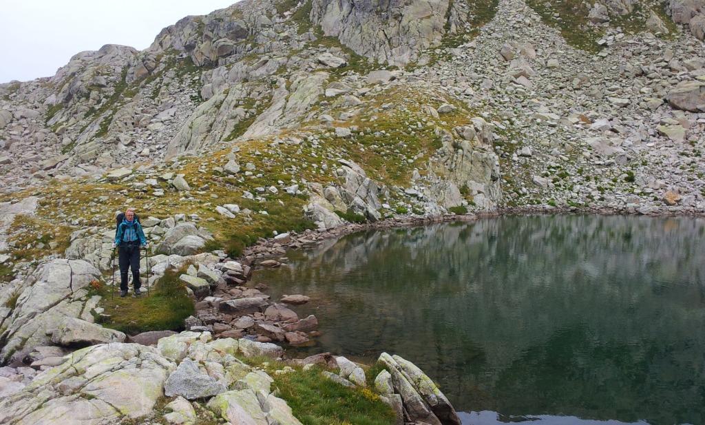
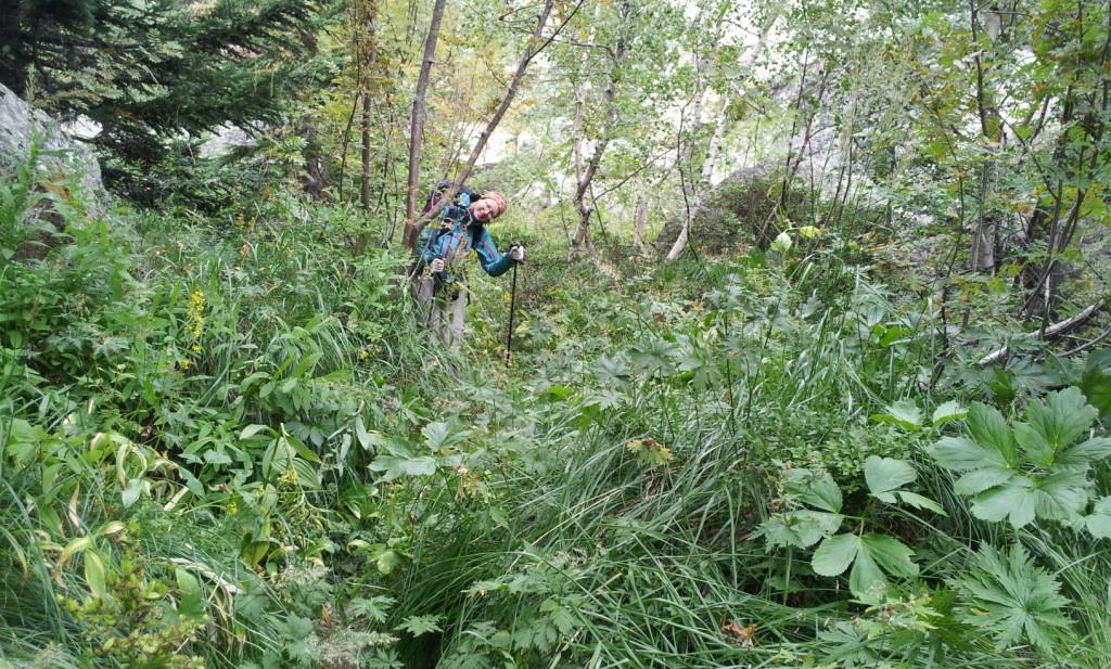
Last night, rodents have nibbled on our waste; the bag with the waste is considerably damaged. Luckily, we had stored it at some distance from our tent, so the animals did not disturb us in our sleep. After breakfast and packing, we continue climbing towards the col. The last part of the climb is so steep that I am glad that I am ascending it and not descending. At the col in the lee of the rocks we have a break before we start with the descent towards the refuge Wallon on the other side of the pass. In the meadow in front of the refuge, we have a long lunch in the shade of the trees. After two hours, we continue towards lac d'Arratille. Because the sun and temperature, we break the climb in 2 parts; in the shade of a tree we have another long break. At the lake, we see that we are not the only ones who want to spend the night there. There are plenty of spots for a tent, so it is not difficult to find a suitable spot for our tent.
Thursday August 23rd: Lac de Arratille - Plateau d'Ossoue
Statistics:distance: ca 14 km
up: 900 m, down: 1300 m,
weather: sunny, some minor clouds and windy.

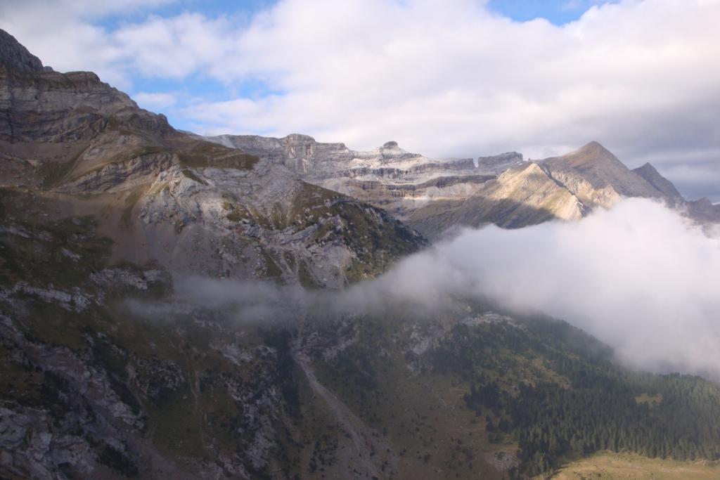
Today we start with a climb towards Col d'Arratille. This goes smoothly in the shade and reasonably well in the lee. On top of the pass is very windy, so I quickly pulled on my fleece sweater. On the Spanish side of the ridge, we traverse along the slope to the Col Mullet. Again it is quite windy and that's apparently more often the case, since there is a wall at the col behind which you can shelter from the wind. The descent is steep, but doable. At the plain near refuge Oulette de Gaube we have an early lunch. After lunch we climb over the GR10 to Hourquette d'Ossoue. Nine years ago, we have walked here too and at that time we have spend the night halfway the climb, the wall that Edwin had built as shelter from the wind still stands. After the Hourquette we descend. Again it is quite windy, but this time we do have good vision, something we had not nine years ago, when we were above the clouds at the col and during the descent we entered the clouds and finally we end up underneath them and at a certain moment we got wet with rain. This year we divide the very long descent into 2 pieces and put up our tent at the beginning of Plateau d'Ossoue.
Friday August 24th: Plateau d'Ossoue - Cabane de Pailla
Statistics:distance: 16 km
up: 550 m, down: 600 m,
weather: Sunnyspells.
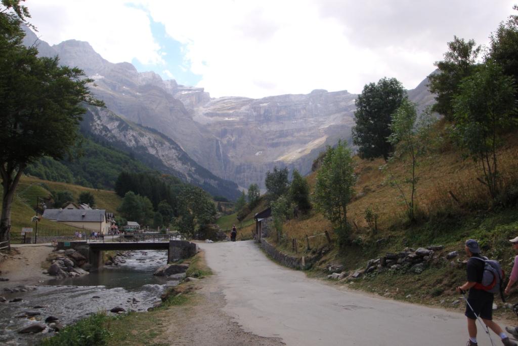
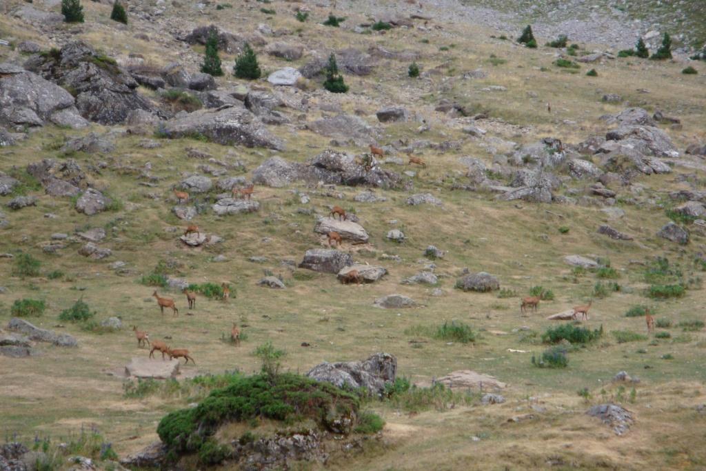
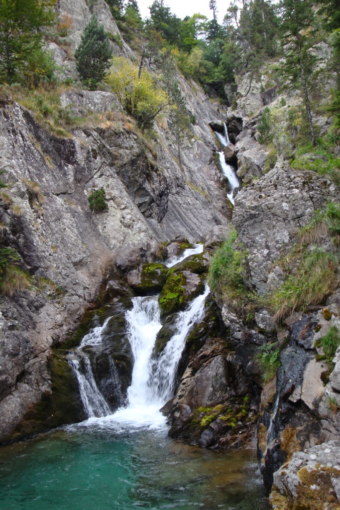
After breakfast we break down our camp and we walk to the barrage and on the other side of the barrage we continue towards cabane de Lourdes. After the barrage, the path goes more up than down, but we still have to descend hundreds of meters before we are in Gavarnie. After cabane de Lourdes the path goes up and down to the next hut. After this cabin the path really starts to fall. We pass the point where we almost lost track 9 years ago; it was quite foggy and at a given moment the path made a sharp bend to circumvent a precipice. With good weather, the course of the route is obvious, but that is not the case with poor visibility. In Gavarnie in the shade we keep an extended lunch with bread, French cheese, yoghurt and juice. After the lunch we walk a only a little further to the other side of the town. Because we have only a one hour walk after Gavarnie we are having another break and enjoy the view and continue with people watching. A little after 4 o'Clock, we leave Gavarnie. The climb to the cabin Pailla is gradual, but due to the heat and the lack of wind I soon get the feeling to sit in a sauna and forgot to take off my clothes. Shortly after a pause at a brook where we refuel and fill the bottles with water, we come to the hut. We are the first for the evening, so we decide to sleep in the hut. In front of the hut we have a magnificent view on the mountains and later that evening on a huge group of playing chamois.
Saturday August 25th: Cabane de Pailla - Héas
Statistics:distance: ca 16 km
up: 600 m, down: 900 m,
weather: Sunny in the morning, clouded in the afternoon and some drizzle late in the afternoon
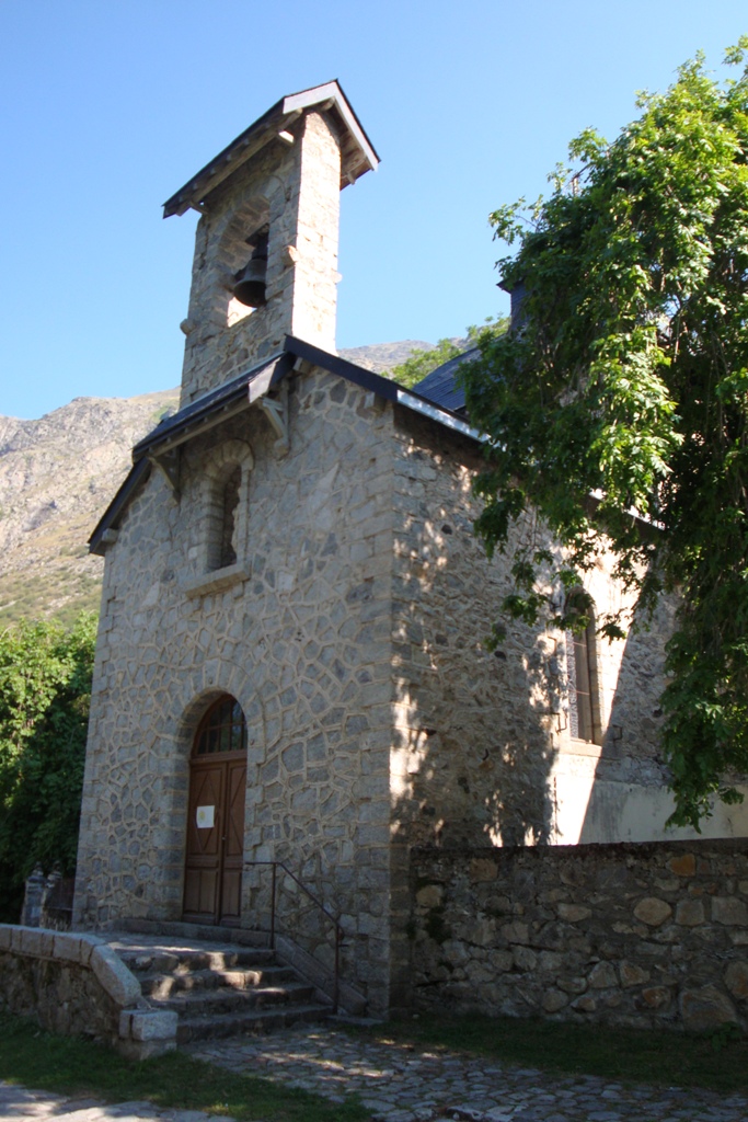
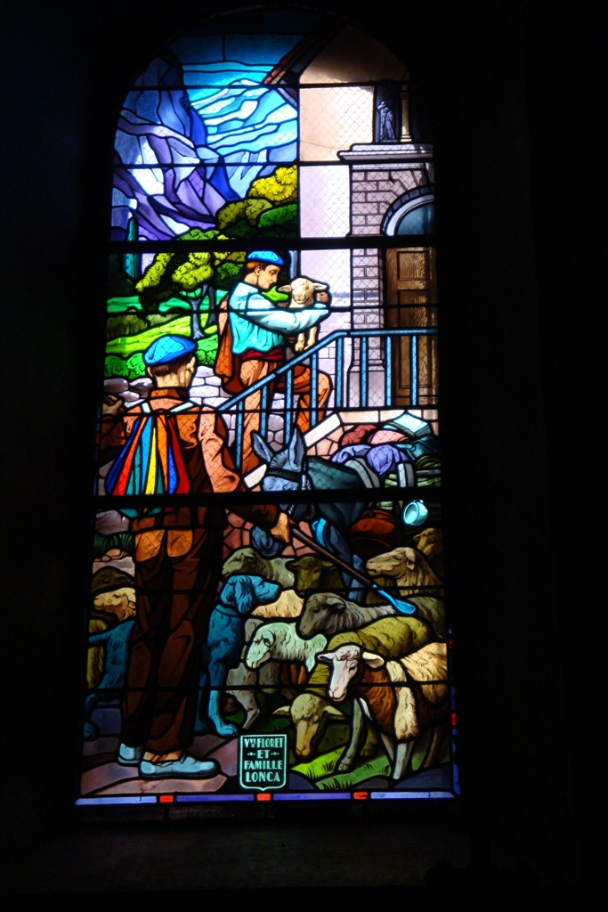
After breakfast with tea and porridge, we pack the sleeping bags and into our backpack. Since we have slept in the cabane last night, we do not have to break down our tent. Right away, we start with a climb to refuge d'Espuguette, or actually we continue the climb that we have started yesterday. The first part of the climb is more steep, but soon follows a slightly flatter part. At the hut we have a break to enjoy the sun and the view on e.g. the Cirque de Gavarnie. During the break we see an employee of the hut, who burns a bag with waste in a metal tonne. This makes us think of Nepal where we were 10 months ago; over there especially high in the mountains they burn most of their waste, not outside but inside to not spill the heat. After the break we continue climbing, now to Hourquette d'Alans. Although it is not a steep climb, we stop several times not to catch up our breath, but to make pictures of the view. After a short break at the col we start with the descent to Lac des Gloriettes. Approximately halfway the desent we have our lunch break in the sun. Shortly after the break we enter the clouds. First, we intended to camp at the side of Lac des Gloriettes, but partially due to the weather and partially due to the surroundings we decide to go all the way to the hamlet Héas. Here we put up our tent at the campsite near the chapel which we visit later in the afternoon.
Sunday August 26th: Héas - Lac de Barroude
Statistics:distance: ca 13 km
up: 1200 m, down: 200 m,
weather: foggy early in the morning but soon clearing and getting sunny
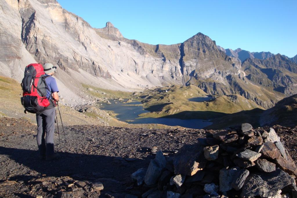
When we awake, it is slightly foggy, but it promisses to be a beautiful day. As for today, a relatively short stage is on the program, we do it nice and easy. At 9 o'clock we start walking. First a steep climb to cabane de l'Aguila and then continue climbing to cabane d'Aguillous. During a short break after the second hut, we notice that we had to turn left at the hut. A more allert walker did take the right path, so we can see where our route is going. After the break we walk 'a la improviste' to the path that will bring us to Hourquette d'Héas. When we join the path, we start with the final climb to the hourquette. Via larger and smaller zigzags the path brings us to the hourquette. After a lunch break in the sun on the pass, we have to descend first to a height of 2300 m before we are allowed to climb to the next col, hourquette de Chermentas. After another break we descend a little on the other side, then we follow a more or less horizontal path under a cliff. After passing the cliff, the trail climbs a bit, the last real climb for today. Now follows a gently sloping path until we reach the lacs de Barroude, where we set up camp on a peninsula in the largest lake. Because the lake is just under a rock, the lake and hence the peninsula soon lie in the shade. And yes, without the warmth of the sun it gets cold fast at a height of 2500 m.
Monday August 27th: Lac de Barroude - Bielsa
Statistics:distance: ca 15 km
up: 150 m, down: 1500 m,
weather: sunny
After the usual breakfast of porridge and tea, we break our camp again. As early as yesterday our camp ended up in the shade, so early the sun shines on the lake again. So despite the early hour we climb in the sun to col de Barroude on the border of France and Spain. At the Spanish side, the course of the path is not immediately clear. So we descend a little in the direction indicated by the sign before Edwin notice a path slightly lower. Besides some minor obstructions, like the absence of a bridge over a deep brook, the descent is fairly easy. Despite the gradual descent I feel my knees a remainder of the fast descent from lac des Gloriettes to Héas. The brook Barossa which we have to cross, flows mainly beyond the rocks resulting in a very Spanish dry stream bed. Later the brook flows on top of the rocks. The last unpaved part goes along the decayed mining town of Hospital de Parzan. The remaining part of today is paved with tarmac, the A13 in the direction of Parzan and Bielsa. After about 1 km at an old customs house, we can ride with a couple from Germany to Bielsa what saves us surely 7 km asphalt walking. We put up our tent at camping Bielsa. After lunch, we first wash some clothes and then ourselves. Later in the afternoon, we do some shopping for todays dinner in Bielsa (approx. 15 min walk from the campsite). In Bielsa we make a reservation for a taxi on Monday morning.
Tuesday August 28th: Bielsa
Statistics:distance: 2 km
up: 50 m, down: 50 m,
weather: sunny
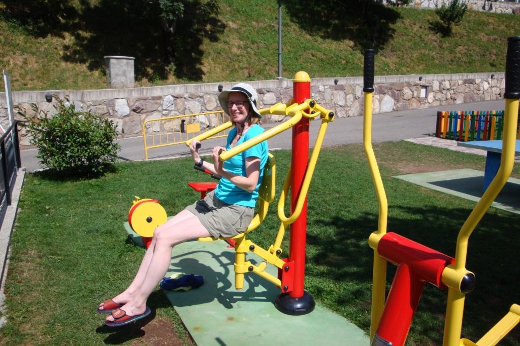
Today we have a rest day. We start the day with warm bread and jam and tea. Then we wait until the sun is heating the tent. Once it gets too warm in the tent, we first go shopping in Bielsa. We are not completely succesful - we have to replace oatmeal with cereals and crips bread (knäckebröd) with toasted bread. After returning to the campsite we put the mattresses outside in the shade of a tree. Despite that I did the wash yesterday, I decide to wash a shirt and some handkerchiefs. Later in the afternoon, we go to the swimming pool where Edwin takes a 'dip'. We also try the outdoor fitness - playground for adults - next to the pool. In the evening we go out to eat in the restaurant at the campsite.
Wednesday August 29th: Bielsa - Camping El Forcallo
Statistics:distance: 22 km
up: 1450 m, down: 700 m,
weather: sunnyspells
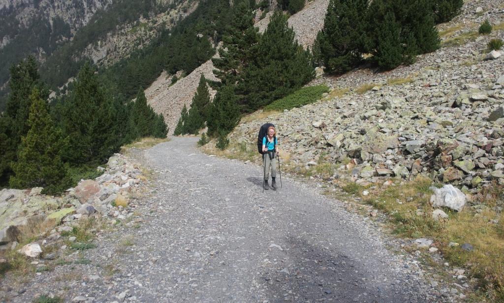
Today will be the day of the large travers on unpaved roads. After breakfast with bread with jam and tea we break up the tent, walk to the entrance of the campsite and wait on the for the taxi that will bring us to point where the GR11 leaves the A13. It comes at the agreed time and soon we are again back on the trail. We start immediately with the climb via the GR11 on a dirt road to Paso de los Caballos. During the climb we have 2 breaks because after the rest day the backpacks are full and heavy. . Almost the entire climb is gradual, only the last part is quite steep; here our path leaves the dirt road to shortcut a long hairpin bend. A little after passing the col we have our lunch break. After lunch we continue to Collado de las Collas. Before the col, our route joins another dirt road and first descends to the 1800 m before it starts climbing to the col. After the col we descend through many shortcuts to the valley of Cinqueta. Once there, we walk over a slightly rising dirt road to the campsite El Forcallo, where we put up our tent.
Thursday August 30th: Camping El Forcallo - Refuge de Prat-Cazeneuve
Statistics:distance: ca 12 km
up: 1100 m, down: 650 m,
weather: clouded with rain in the afternoon
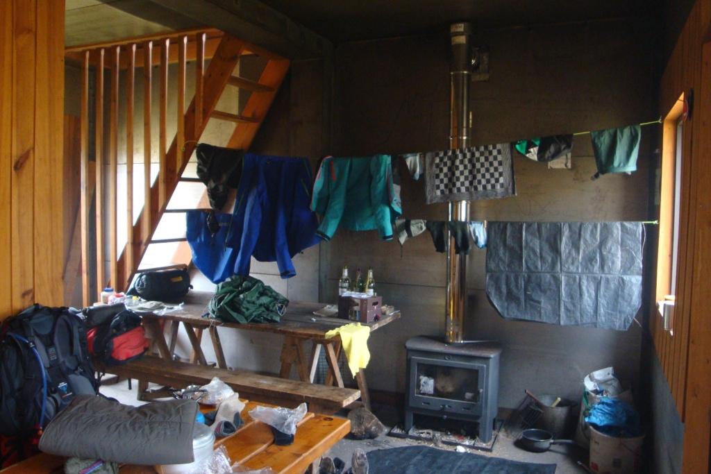
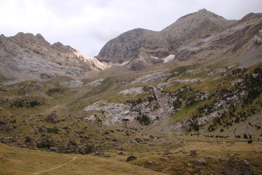
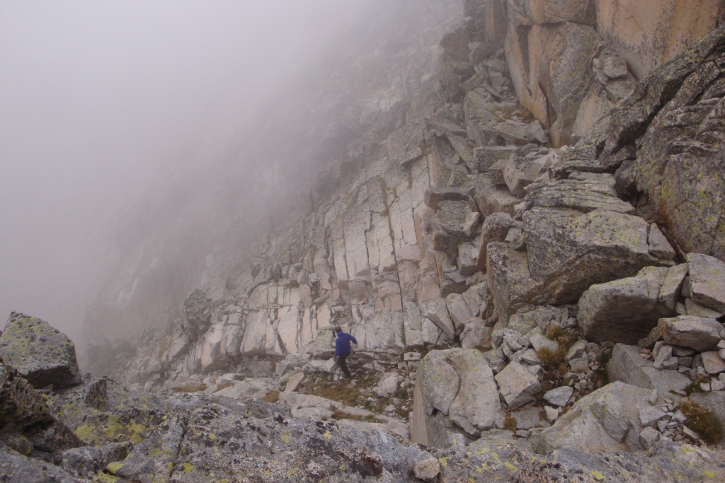
Today, we have breakfast with chocolate shells in very watery and cold milk with hot tea, next time we have to add more milk powder. Then we packed our backpacks and broken down the tent. A little after 8 we start the climb to refuge Biados. Here we come to the conclusion that we should have ignored the last crossing of the GR11, because after the cabin the GR11 descends back to the dirt road that we had crossed a little earlier. From the dirt road, the route follows a gradually rising path. After an hour walk along the path, the valley splits up. Here we leave the GR11 and climb straight ahead on a trail marked with cairns. The first part of this climb is going well. Later the path is quite steep until we reach a narrow gap. Here we have to go almost straight up. After the gap follows a completely different landscape, more grass but unfortunately less cairns, which we followed as well as possible. Just before the port d'Aygues Tortes we pull on our raincoats - unfortunately not our rainpants - because the clouds whhich we have entered do not retain all their water. Soon after the climb it really starts raining. Becoming wetter and wetter we descend. First through rocky landscape, later on a narrow path surrounded by high grass. At about half past three we arrive soaked at an unmanned hut. Inside a stove is lighted by a French couple who is about to leave when we arrive and they are so kind to leave the stove on. That evening we are the only ones in the cabin, so there is enough space to dry our cloths. The chimney draws not always good and occasionally, the smoke enters the cabin. Before we go to bed on the second floor of the cabin, we temper the stove.
Friday August 31st: Refuge de Prat-Cazeneuve - Refuge du Portillon
Statistics:distance: ca 12 km
up: 600 m, down: 400 m,
weather: cold, some snow flakes
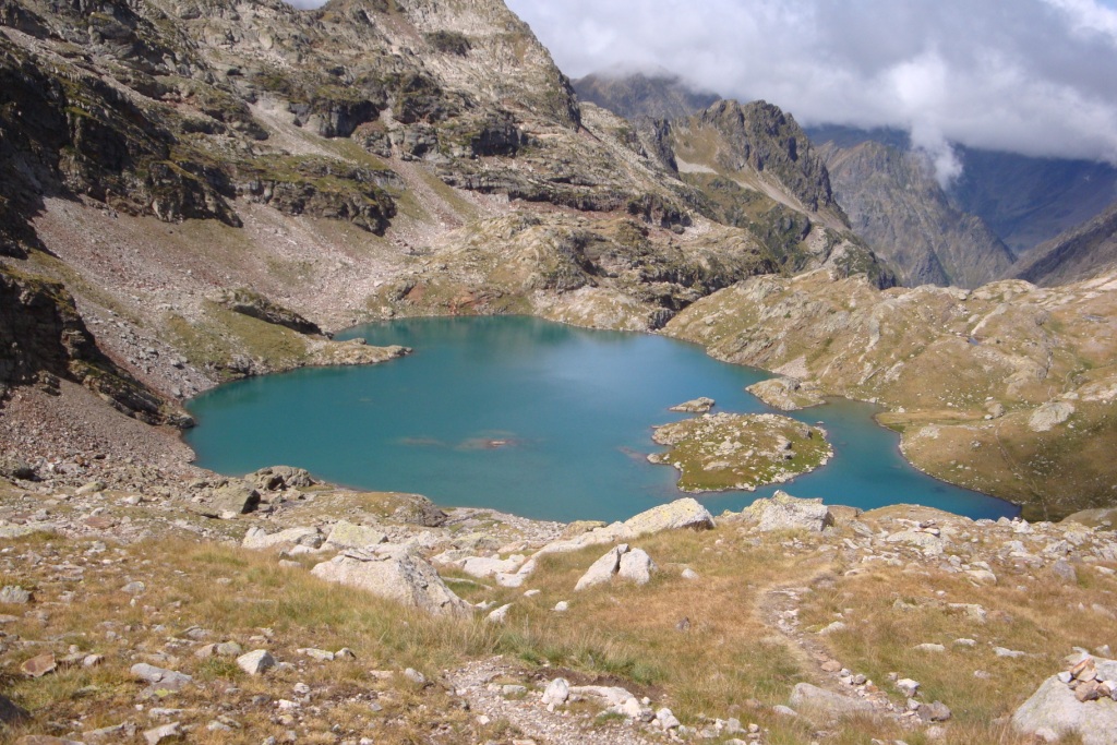

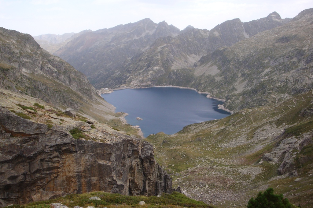
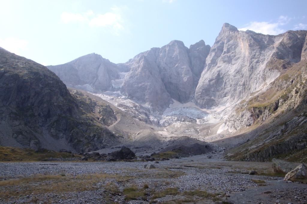
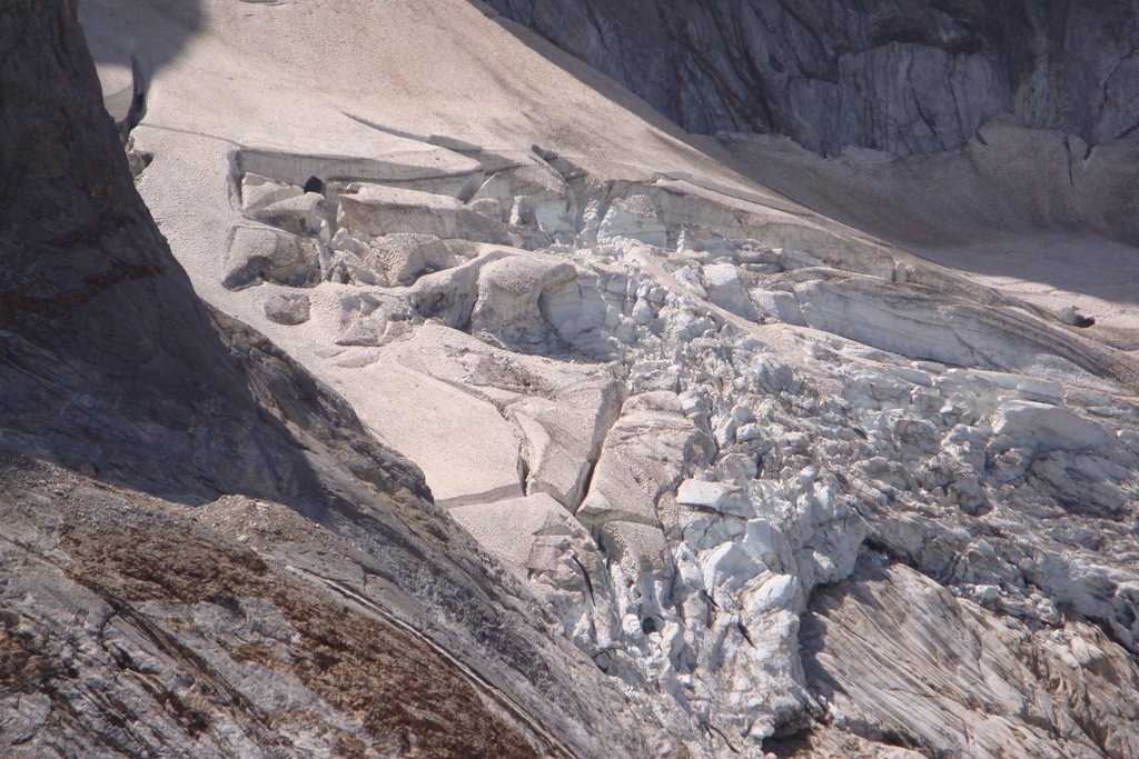
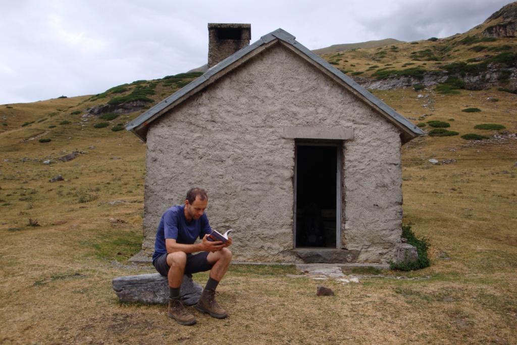
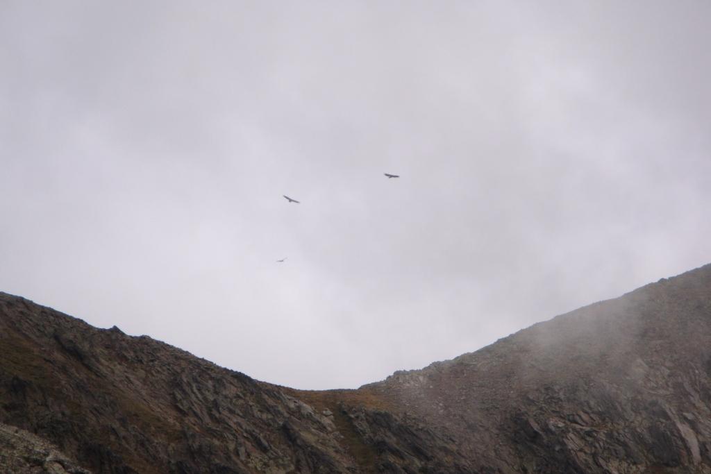
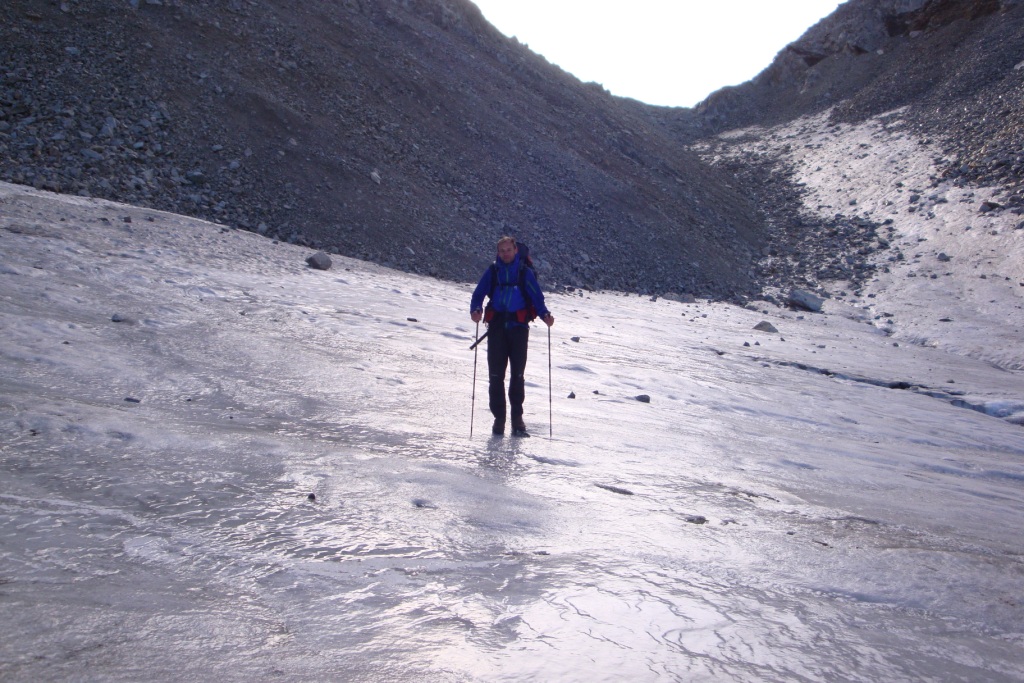
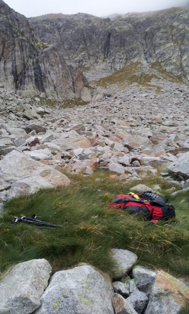
During the night we had a beautiful view on the well moonlighted mountains, which we have not seen the day before because of the clouds. Next morning it is quite cold inside the hut, only 9 °C. After breakfast with chocolat shells, cold milk and hot tea, we pack our backpacks and check if we did not forget anything. A little before 8, we leave and take an alternative route that keeps height. This appears to be a good choice: the path is very that a some point seems to be a dead end, until we read the sign on the door "Fermé la porte"; the path goes through the building. After the nice path we pass by several lakes. At the third lake, Lac Milieu, we take our lunch break. After lunch we pull on our rainpants and pull the raincover over our backpacks, just in case. Next part of the route consists of rock blocks followed by loose debris and rocks again. We climb higher and higher and at some point it starts snowing a little, we come to a field of snow and a glacier. Walking on large rocks always takes me more time than the books indicate, as this time. When we get to the last col we still have to pass a summit to get to refuge Portillon. In the descent to the hut we get confused and we take a wrong track, but at half 8 are we at the hut after all. Because it is cold and windy and the landscape is very rocky, we decide to sleep in the hut. It's very quiet and we have a 12 room for the two of us.
Saturday September 1st: Refuge du Portillon - near end of paved road through valle d'Esera
Statistics:distance: ca 14 km
up: 500 m, down: 1200 m,
weather: cold
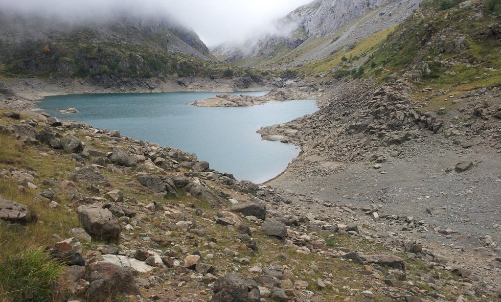
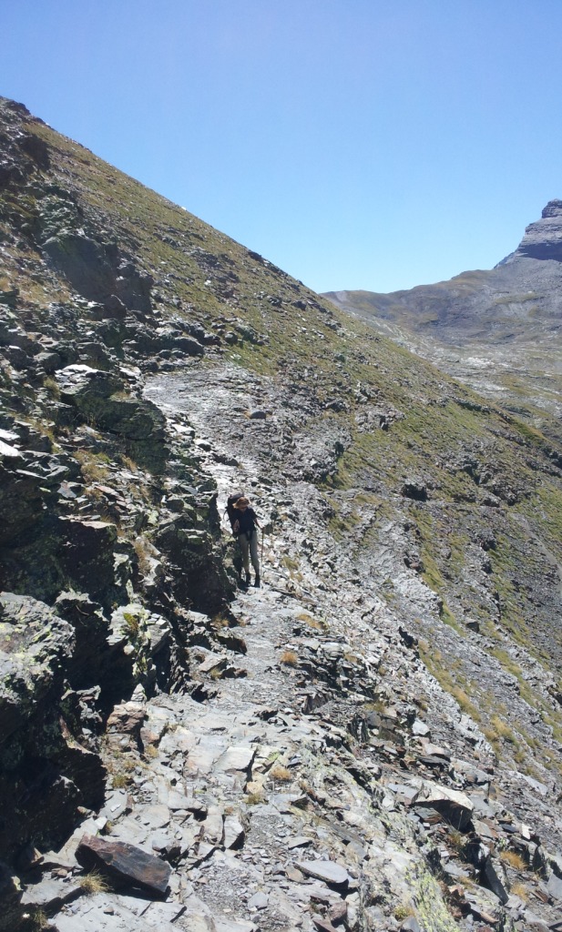
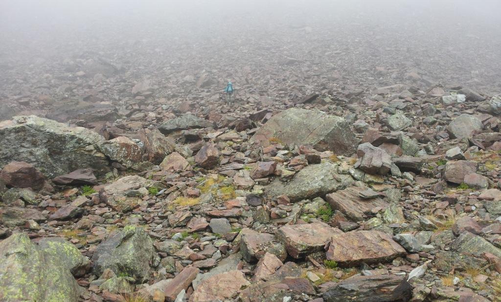
Because today promisses to be a long and difficult day, we get up early, have tea and porridge for breakfast, pack our backpacks and go. At least that was the intention, but we still have to pay and also the connecting door (unintentionally) is locked. But a little before 8 o'clock we are on our way again. We start with crossing the barrage next to the refuge followed by a steep climb to a subcol. Next is a icy snow field that we have to cross. Luckily it is not fully iced and in some places the snow is almost or completely gone. After the snow field follows the last part of the climb to the Col Inferior de Literole (2983 m) through the freezing cold. On the other side of the col we first gently warm my hands, because they are thoroughly cold even though I wore gloves. The first part of the descent is almost vertical, so Edwin investigate it first without and then descends with my backpack and finally with his own backpack. I follow without backpack. Once the descent gets less steep, I take my own backpack. We traverse a valley to the next col and pass Lac de Literole at a some distance. Next is a huge granite field consisting of boulders and slabs. With some difficulty we find our way to the point where the route actually begins to descend over rubble and boulders. After lunch the trail is a little better, but we still have to watch out. In the forest the brook flows through deep gullies and sometimes it flows even completely underground. After the woods we walk through an open field to Benasque Hospital, where can get rid of our waste collected in the last few days. Via a paved road closed to traffic we walk further east to a height of 1920 m. Here we put our tent on some distance from the road.
Sunday September 2nd: near end of paved road through valle d'Esera - At 2300 m in vall de Salenques
Statistics:distance: ca 11 km
up: 1100 m, down: 100 m,
weather: cold and foggy
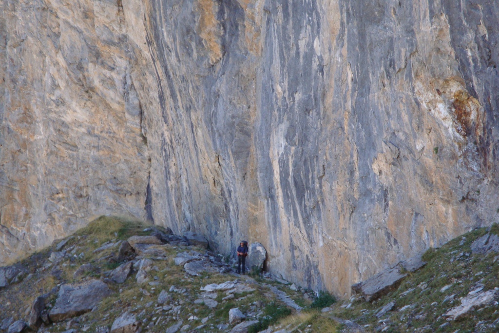
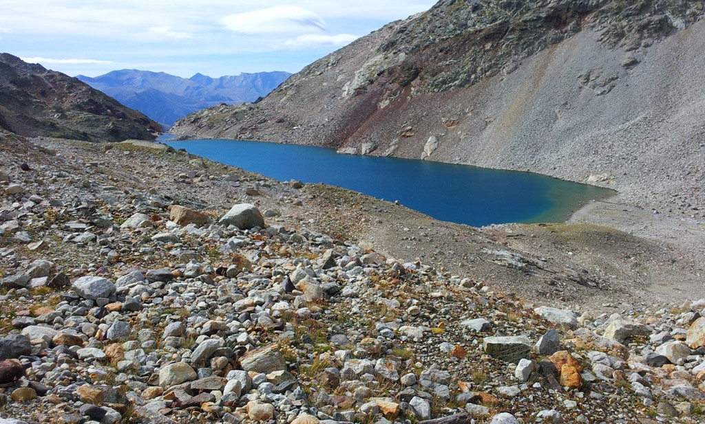
After a good night, we have breakfast with porridge and tea before we wrap the whole thing and break down the tent. In the beginning there paaltjes along the path. After a sunken lake go the paaltjes are replaced by cairns, which lead us along the left side along the lake high up the slope. Then we come to a grassy slope and not on a grassy plain, which is already fishy. Continued climbing brings us too fast to another lake. Now it is clear to us, especially since the cairns have disappeared, that we are on the wrong track. We climb slightly higher to a comb. From here we see the path in the valley where we should have walked. Over a grassy slope we descend to the path that soon leads us to a deep "sinkhole" where many water enters but apparently nothing escapes. If near the "sinkhole" is a waterfall and above it a real grass plain we know that we're on the right track. After passing the grassy plain we climb towards Coll des Toros. After the first part of the climb we see walkers, two couples. Higher the path splits and we follow the path that is marked Muleres. At 2300 m we walk along two lakes. After these two the real climbing starts but not before we have an early lunch. After lunch we climb to Estany d'Escaleta and straight to a lake that lies at 2650 m. At 2500 m, we have a discussion on the route, we were already further than we expected, and after a good look, we find the lake on the map. Just before the lake at 2650 m we see a German couple; because of the cold they returned. At the lake we see a number of suitable spots for a tent. At this point we are still on the right track. From the lake we follow cairns on rock slabs, that later turn into larger and smaller rocks. Now it is more difficult to find and follow the cairns. At 2800 m altitude, we speak two French men, who also returned; they say they have been at the col but did not dare to descend. Since we know the upcoming steep descent, we continue climbing, now through the channel of a dry stream. At the top we across a comb. Hindsight I send Edwin to the west instead of south to search for the col. It is quite foggy, but soon Edwin finds a col which fulfills the description. He returns to pick up me and his backpack. Together we walk to the pass, descend a bit along the ridge before we cross the pass and descend carefully on the other side. After a nearly vertical part we come to a screeslope. As we descend a little further, we see that we did not pass the coll at the lowest point. Meanwhile, we can also look a little further into the valley and can not find the lake where we should descend to. When we arrive a little lower at a new section that is very steep, we know we are on the wrong track. Nevertheless, we continue to descend carefully through various gorges. At 8 o'clock we find a patch of grass that is just flat enough to put up the tent without the danger of us immediately sliding out the tent. When Edwin prepares dinner, I study the map and guess we have descended into the wrong valley. Edwins GPS confirms this. We have not passed the Col Mulleres, but a in appearance nearly identical unnamed col and thus ended up in Valle de Salenques. Thankfully there appears to be a path through this valley, so we do not have to go back. After dinner we prepare for an uneasy night, because of the wind blowing along the tent and us sliding inside the tent.
Monday September 3rd: at 2300 m in vall de Salenques - Hospital de Vielha
Statistics:distance: ca 11 km
up: 225 m, down: 900 m,
weather: clouded and not very warm
After a night with little sleep, it is cold in the tent when we awake. After breakfast with hot porridge and tea, we pack the backpacks as far as possible and we break down the tent in a special way to prevent it from blowing away. When everything is packed, we start walking. Soon we arrive at the first cairn. Although it is difficult to follow the cairns in the rocky valley - the valley is almost from top to bottom filled with rocks ranging from the size cochlea to house. In the beginning we surely lost sight of the cairns several times, but they are always found again. Lower in the valley, the first faint trace becomes clearer and finally it becomes a real path. Also, the vegetation gets more exuberant. Because only few people visit this valley so there are still plenty of blueberries, which unfortunately are not really, or better said really not sweet. We also see no traces of cattle and barely feces of wildlife in the valley. After a 2 hour walk we pass a stone wall with a narrow opening - the first real sign of human civilization. At half past 12 we have lunch at a waterfall, the stream where we have walk along since last night has grown into a serious stream. At 2 o'clock we come to the conclusion that we have descended only 1200 m during the last 12 hours we were walking, this slowly we have never descended, this shows how difficult walking is in this valley. But now the path is really better, we descend a lot faster and soon we see a growing number of signs of human activities, like signs which lead us to the GR11 and even a picnic table. We decide to go to the GR11 on the other bank of the river, because it will bring us back to the HRP in Hospital de Vielha. When we walk on the GR11, we see other hikers and that is very pleasant after our adventure from last 24 hours. At Hospital de Vielha we leave the trail and soon we get a lift to Vielha. From there we take the bus to Les - the last village in Spain before the border with France - where we stay overnight at the campsite.
Epilogue
Tuesday, September 4th we have breakfast with the last chocolate shells, and we quietly pack our backpacks and tear down the tent. We walk to the French side of Les. It appears that many French people come here and buy liquor (especially wiskhey) and tobacco. I speak to a French couple and we can ride with them to France to Bertren a place almost halfway the Frence border and Montréjeau. From Bertren we walk to the next train station and it appears that the train that will bring us to our car comes within 6 minutes. From the station of Montréjeau we drive by car to Luz-Saint-Sauveur where we stay on "Camping Bergons" in Esterre for a few days before we go home.To be continued

Last modified December 2012