GR10: Our story
Part 3: St-Lary-Soulan - Auzat
From August 8th until 23rd 2005 we did the third part of the GR10: from St-Lary-Soulan to Auzat.
August 6th, we drive from Doetinchem to Montréjeaux, where we arrive August 7th. Here we park the car and take the train to Lannemezan and from there the bus to St-Lary-Soulan. We arrive in St-Lary just after noon. We go to the same camping site as two years ago. Here we recover from the journey.
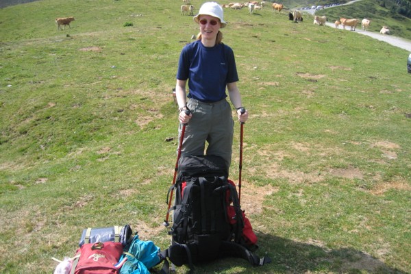 Next morning we left St-Lary-Soulan for the second time and started with the third part of our hike along the GR10. We decided to do the track from St-Lary-Soulan to Loudenvielle for a second time for several reasons: (1) this part was not too hard to do, (2) because of the rain we didn't see a lot the first time and (3) we didn't want to walk 15 km along the road from Aurreau to Loudenvielle. Because it was our first day in the mountains, the climb was harder than we remembered from 2003, but any how before noon we were already at the Couret de Latuhe. This time we saw a lot more than two years ago when it was pooring with rain. After a short break at the couret we descended to Loudenvielle where we arrived just before midday closing time of the local supermarket. In the supermarket we did some groceries for lunch, which we used on a lawn in Loudenvielle. After lunch we rested for another while before we started our climb to Germ. During the climb we noticed that the heat is making us quite tired. Just outside Germ we found a nice place to pitch our tent in a pasture. Because of the dark clouds closing in on us we decided to put up the tent before the thunderstorm arrives.
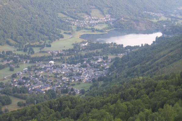
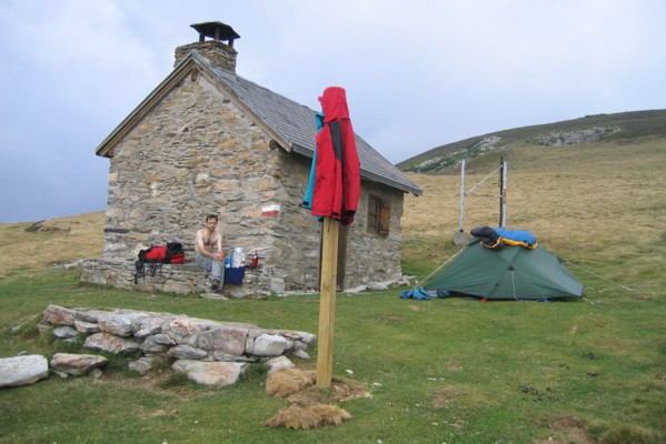
After a good night sleep we are ready for the new day. The sun is shining and it promisses to be a nice day. Not long after we have left our "camping site" we caught a last glimpse of Loudenvielle. Till an altitude of 1600 m the route climbs a little. There after the track starts to climb more seriously. We succeeded in reaching the col at lunch time. The view is nice and the sun is burning on our white bodies. Today we keep our lunch break shorter, because we want to go all the way to Lac d'Oo, so we have a decent and another ascent ahead of us. The descent is not too hard, but at the end my feet are hurting. On our way down through the forrest some men with no respect for nature are almost shooting themselves from the mountain creating a lot of falling debris and dust-clouds, passed us. I'm not fond of people like that. We have a short break at the refuge with crepes and ice tea. When you're fit the climb from the valley of Astau is all right, but at the end of our second day after already a climb and descent it was hard to take for us. At lac d'Oo we were lucky and found a nice place to pitch our tent for the night. During the evening we were visited by another thunderstorm.
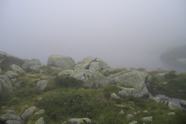
 Next day started sunny, however during the afternoon wind came followed by fog and raindrops. The climb to hourquette des Hounts-Sec went fine, because most of the time we were walking in the shade of the mountain what prevented that we were getting overheated. Just after the gros rocher (the big rock) and at the hourquette we took a short break. Because it was too early to have lunch at the hourquette we decided to continue with the descent and have lunch somewhere between the hourquette and col de la Coume de Bourg. The descent went that well, that Edwin decided to go all the way to the col before lunch. For him it was not a problem, but for me it was too much. It took me more time than needed when I had enough energy. After lunch at the col we descended to a small source to fill our water bottles and continue our way to Superbagnères. Here we notice that the course of the GR10 has been changed compared to our booklet - the GR10 leaves the road just before it enters Superbagnères. By the time we approach the little ugly skiing place fog is closing in. Because the weather is getting worse we continued descending till we found a nice place for our tent at the edge of the forrest and out of sight of the ugly skiing place. During the evening it started to rain.
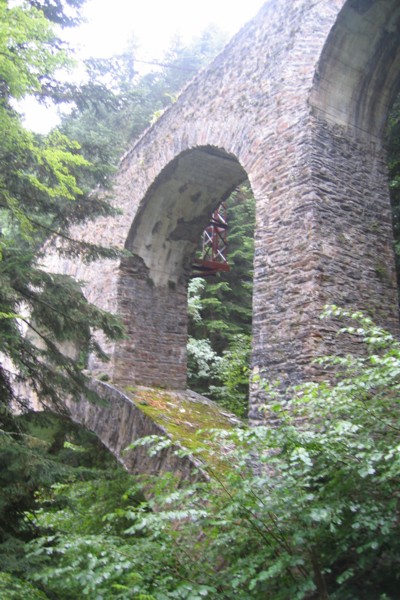 The next morning it was still raining. The rain made a brooklet from the road, through which it was more slippery. Anyhow, without a scratch we reached Bagnères-de-Luchon. On our way down we passed some remainings of the former railway viaduct "Viaduct du Mailh Trincat".
 In Bagnères we did some shopping and had a break before we continued our way to Sode. By the time we continued the rain had stopped, so our shoes and clothes started to dry on our way to Juzet-de-Luchon. Here we took off our rain clothes before we started the climb to Sode. At Sode we had lunch on a stone wall. During lunch we spread out our tent to let it dry a little. After lunch we went to Artigue. Here we met a little boy fishing for tadpoles that were swimming in a tray near the source of the village. We continued our way leaving the village and climbing towards the cabane de Saunères. Next to the shelter we pitched our tent for the night.
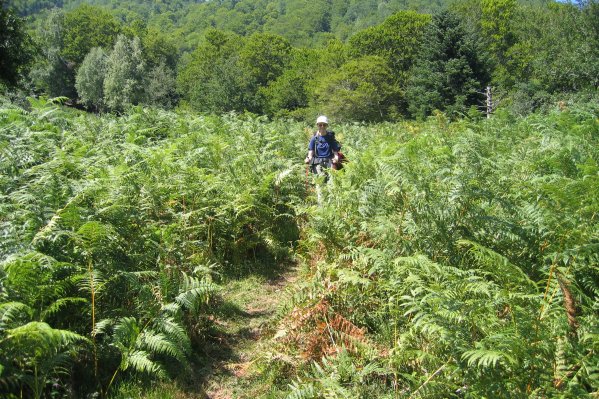 After a good night sleep, the sun is shining. The climb to the col of Peyrahitta went very well. At the water place on the plateau of Montmajou we got confused because there are three paths, the GR10-signs continue climbing in the direction of Spanish border, in our booklet the GR10 follows the lower trail. We decided to follow the route as described in the booklet, only the path descends more than the booklet describes. But after all we reached the pass of Dessus and some time later the pool of Cigalères without too much difficulty. Before we stopped for lunch we descended towards cabane de Courous. After lunch we descended through the woods. The path is long, steep, muddy and slippery and therefore tiring. However, finally after four hours we reach Fos, the village where we want to stay for two nights, for washing our clothes, doing some shopping and have some rest. Only the bakery is the only shop in the village and the bus to a nearby village with more shops is going once a week, but not on Saturday. So we decided to do the washing already Friday evening to have more time for the shopping next day.
Although it was not a walking day, we rose early. We hitch-hiked in two stages back to our car in Montréjeaux. Here Edwin shaved himself and there after we drove to a nearby supermarket. After the shopping, we parked the car at the carpark of railway station and continued our journey by bus to Cierp-Gaud. From here we hitch-hiked back to the camping site, again in two stages. At about 2 o'Clock in the afternoon we can enjoy our day off.
Sunday morning 14 August we rose one hour earlier than normally on a walking day, because we have a long climb ahead. It is cold and clouded when we break down our tent. We walk along the road to Melles, like described in our booklet. It is a nice climb to Melles. Just outside Melles a young dog accompanies us for more than one kilometer. Finally he goes into a yard and our ways separate. We continue. Beyond expectations, the climb goes well. In the mean time the sun has started to shine. We enjoy the view on the valley when possible.
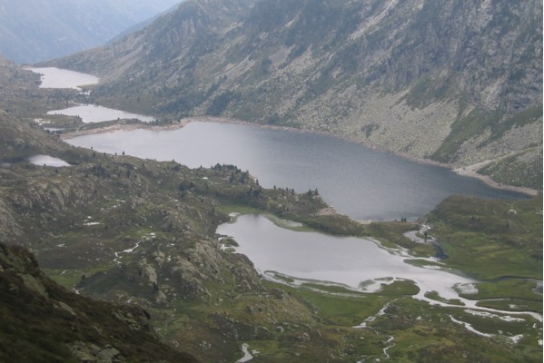
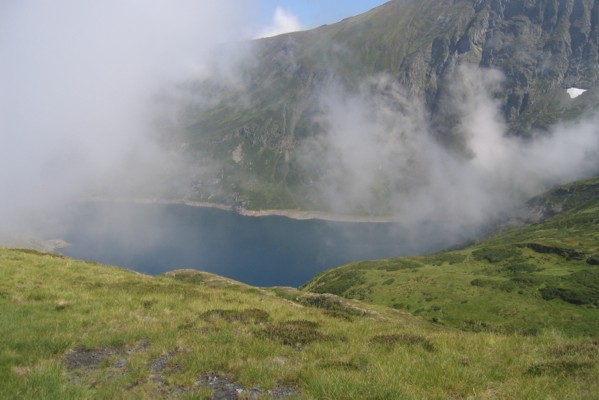 At 12:30 we are at plateau Marécageux (1830 m). Here we have an extensive lunch break. The first part of the climb towards the pass after lunch is very steep and after the pass the route continues to climb more gradually. The part between the pass of Bouc and the coll of Auérau is easy walking. Near the coll there is a small snow field. Finally we descended to the refuge, where we have a hot chocolat. In the mean time it is getting a little foggy. For the night we pitch the tent near the barier at the end of lake Araing.
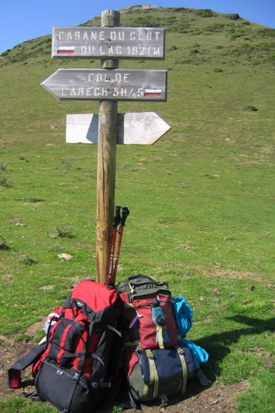
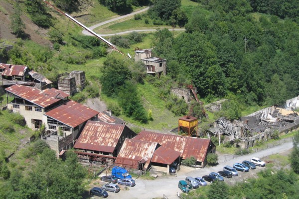 Next morning we start crossing the barrier, followed by a short climb to the serre d'Araing. On the serre we see the first signs of the former mining activities. After crossing the serre the route descends through the mountain pasture towards the buildings of the mine of Bentaillou. Just before the buildings we have a break to enjoy the view and see something more of the mining activities. After the break we descended towards the buildings and continue on a leveled part. A little later the route descends towards Eylie. Just before Eylie we leave the route for a while and continue to desecend to Eylie. Here we took the road to the abandonned factories. Here we have a lunch break in a small stripe of shade, with a view on the ruinous factories and ancient pipeline from the mines to the plant. Because of the sun and temperature, we climb in small stages to the col of Arech. Here we find a small place to pitch the tent for the night. Before we go to sleep we explore the route for next morning.
When walking along the explored route we discover that we are on the wrong track. From the hillside we see the cabin of Arech in the valley. We decide to descend straight through the mountain pasture to the cabin. Here we notice that the place where we spent the night was not to the col of Arech.
 Near the cabin is a water source, where we fill our bottles. Here after we continue. The route first follows a narrow road before descending along a small track. The descent is as we like it - not to steep and with a lot of hairpin bends. After the bends the route continues to descend through the forest till Grauillès brook. Here we fill our water bottles again and leave our waste in the garbage can. The route passes the brook and continues on the other side downstream before it goes up again. The first part of the climb is quite steep. We go in small stages up. One of the breaks we have during the ascent, is at the cabin of Besset. Because of the sun, we go inside to shelter for the sun. From clot du Lac to the cabin of Trapech du Milieu the route makes a hugh detour during which the waymarks are sometimes hard to find. Finally we reach the cabin. Because the pasture is too slanting to pitch a tent, we decide to use the cabin for the night. During the night we heared a mouse, or something like that, searching for something to eat. Later that night it got windy and started to rain.
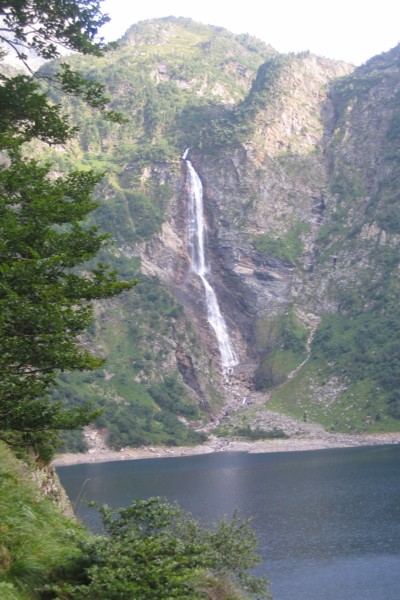
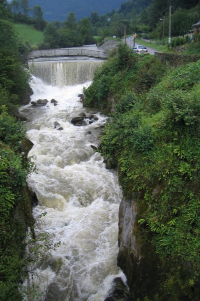
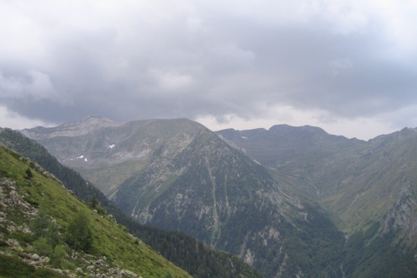 When we awoke next morning the sun was shining. After breakfast we leave the cabin and start to descend in large hairpin bends through the pasture. The descent again went well - 600 m descending without having sour feet at the end and we reach refuge of Pla de la Lau quickly. After the refuge we cross a brook and follow it upstream. The way up starts with a climb along a beautiful waterfall. One time the climb goes smoothly and another time it goes hard, especially the more steep parts. We have lunch near the cabin of Aouen. In the mean time we see black clouds coming and hear some thunder in the distance. When it starts to drop, we go into the cabin for shelter. At 13:15 we continue to climb to cape of Lauses. From here to col of Laziès the route stays more or less on level and offers some great views - because the weather is good again we can see the col where we spent the night two days ago and behind that the old pipeline we passed three days ago. From the col (1840 m) the route descends a little before passing a collet at 1950 m. After the collet the route descends over a rocky path - not one of my favourites - to lake Ayes. Here we pitch the tent on the bank. During the evening we have thunderstorms and hear the water splash on the bank.
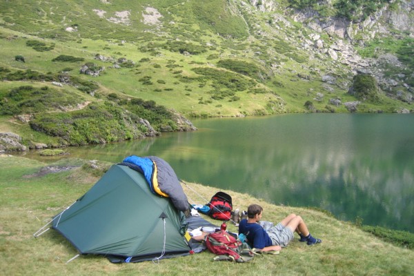 Next morning we packed the tent almost dry. On our way from lake Ayes to Auédole col we take the wrong track what we noticed quite soon. The climb to the col is not too hard. From the col we go East and take a variant of the GR10 to the col of the Core. When we reach the col we are surrounded by clouds and it is cold. We continue to descend and leave the clouds where they belong, above us. The track to Esbints is easy walking. When the GR10 leaves the road, we continue following the road to Seix. In Seix we stay at the camping site for another day of rest. In the afternoon, we go to Seix to do some shopping for next days.
Saturday August 20th the sun is shining when we leave Seix in the direction of Oust. From Oust we follow the GRP Garbet valley tour counter clockwise. Until Plech this route follows a nice track. Between Plech and Perteguet, when the route goes through the forrest we have some difficulties finding the right path. After some searching and a short steep climb we leave the forrest and come on the road to Perteguet. After this hamlet we continue towards Arrous, another hamlet. The route climbs gradually along a paved and later semi-paved road. After lunch it starts to blow, so we pull on our jackets and rain trousers and protect our backpacks with waterproof covers - just in time. Just before Turon d'Isaac the route leaves the road and continue on a small unpaved track through the pasture that ends on a forrest track. From here the route starts to descend towards the D8. When the route leaves the D8 for a shortcut to Sérac d'Ustou the path gets slippery because of the combination of slippery stones and rain. After the hamlet the route follows the rivulet in direction of St Lizier d'Ustou. Here we stay at the camping site for the night. At the camping site we dry our wet clothes in the dryroom.
 Sunday morning it is still raining. Therefore we decide to go back to the D8 via the GRP and to take this road to Aulus les Bains. We leave late - at 11 o'Clock. The path towards the D8 is even more slippery than the day before. It took us one hour to get to the D8. At col de la Trappe we have an extensive break in a small but crowded restaurant. Edwin has a duck leg with patatoes and I have a pizza with Gorizzo, olives, cheese, paprika, tomato, mushrooms and egg. After lunch we descend to Aulus les Bains. In the mean time it stops raining. Again we stay at a camping site.
 After a night without rain, we leave Aulus and join the GR10. At Coumebière we have a break on a picknick table which seems to be designed for giants. Because it is not warm, we continue soon. During the climb to Port of Saleix it gets foggy. In the fog the temperature drops. At Port of Saleix it is very cold and windy. We pitch our tent to have our lunch break in the tent. Out of the wind it is a less cold. From the port the GR10 climbs along the mountain ridge of mount Garias. This is a steep climb over crisscross tracks excisting of loose stones. Hereafter the GR10 descends over a rocky path to lake Alate which is disappearing in the fog. From Bassiès col we have an exciting view on the mountains. The descent from the col to the lake is terrible. A brooklet is streaming along the rocky path. When we finally reach the refuge, we have a hot chocolat.
 Before we pitch the tent we walk along the lake. A little too close to the refuge on a suitable place to pitch a tent - not too rocky and not too wet - we meet two Dutch hikers who want to stay there. We find a place for the tent between the major and minor lake on the right bank near the dam. Because of the wind we fix all tie lines. The wind has a major role during the night. We hear each blow coming along the mountain chain before it hits the tent. In other words, we do not have a good night of sleep.
 Next morning it is still windy and before we leave the tent we make a plan on how to break down the tent. In the morning it drizzles, so we start with our rainpants on. The path along the minor and tiny lake is very wet because of the rain of last days. Along the last of the four lakes, the route slowly descends via huge, flat, not slippery stones. After a while the route started to descend more steeply along large stones and loose stones. We take a break at the ancient viaduct. Since it stopped dizzling, we pull off our rainpants. After the break we leave the GR10 and continue to descend to Auzat. There we have lunch in front of the tourist office. Since there is no time scedule at the busstop, we decide to hitch-hike to the train station of Tarrascone s. Ariege. We get a hike from the Dutch couple we met the day before. From Tarrascone we take the train to Toulouse. At Portet-St-Simon we change trains. At the end of the afternoon we arrive in Montréjeau. Here we take our car and start our journey home. In the evening we arrive at a campsite north of Toulouse along the N20.
August 24th, we drove home.
To be continued in part 4.
![]()