Wainwright's Coast to Coast Walk: Our story - part 3
At Ingleby Cross we took a day off, because our clothes were dirty and we needed some washing too.
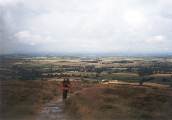 Next day we entered the North York Moors. However we had to climb out of the cultivated low country first. After crossing a bussy road, the A172, we climbed along Arncliffe churche and Hall towards the
Arncliffe Wood. In these woods the Cleveland Way joins the Coast to Coast path. After passing the Scarth Wood Moor the path enters the wood again and desends to Hollin Hill, where it starts
to climb to Live Moor, Carlton Moor and Crinkle Moor. Here a memorial to Alex Falconer is erected. The memorial is also a view point from where you can look over the low country. We continued for a
little while before we had lunch break near Broughton Wood. After lunch we climbed to Hasty Bank, where the impressive Wainstones are.
Next day we entered the North York Moors. However we had to climb out of the cultivated low country first. After crossing a bussy road, the A172, we climbed along Arncliffe churche and Hall towards the
Arncliffe Wood. In these woods the Cleveland Way joins the Coast to Coast path. After passing the Scarth Wood Moor the path enters the wood again and desends to Hollin Hill, where it starts
to climb to Live Moor, Carlton Moor and Crinkle Moor. Here a memorial to Alex Falconer is erected. The memorial is also a view point from where you can look over the low country. We continued for a
little while before we had lunch break near Broughton Wood. After lunch we climbed to Hasty Bank, where the impressive Wainstones are.Because there are no official places to camp near the Clay Bank Top and it was still early, we continued to the Lion Inn at Blackey. The map promised us it was only a 3 hours walk although the distance was 10 miles (16 km). After Clay Bank Top the route climbs along the Carr Ridge and finally really leaves the low country and enters the moor.
On the North York Moor hardly any trees can be found, unlike the Dutch moor, where besides heather also juniper can be found. Only the sheeps on the other hand are more brash than we are used to, they behave like they own the land.
When we reached the dismantled railway we made very good progress allthough we were getting tired and sour feet at the end. Therefor we were glad when we finally reached the Lion Inn. Here we could pitch our tent in the pasture between the sheeps.
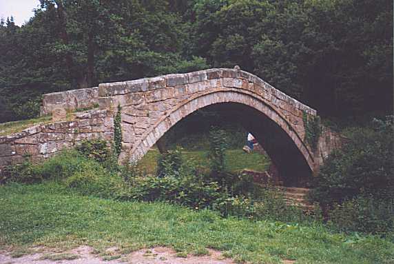 Next day we had good weather. After an early and good start, the path over the moor is comfortable, we reached Glaisdale before lunch. Just outside Glaisdale we took a picture of
the Beggars Bridge, like everybody else. Immidiately here after the path goes into the wood. Sometimes the path is slippery and stones are placed on the path at places where the
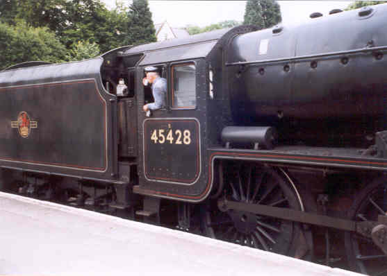
path is the worst. When the route leaves the wood the path becomes of better quality, what favours the progress. Somewhere in the afternoon we reached Grosmont. At the station we took some
icecream and enjoyed the sunshine. During our break at the railway station a steam train entered. It is a real beauty!
Next day we had good weather. After an early and good start, the path over the moor is comfortable, we reached Glaisdale before lunch. Just outside Glaisdale we took a picture of
the Beggars Bridge, like everybody else. Immidiately here after the path goes into the wood. Sometimes the path is slippery and stones are placed on the path at places where the
path is the worst. When the route leaves the wood the path becomes of better quality, what favours the progress. Somewhere in the afternoon we reached Grosmont. At the station we took some
icecream and enjoyed the sunshine. During our break at the railway station a steam train entered. It is a real beauty!After this long break we continued with a very steep climb back to the moor. Here at Grouse Butts, after crossing the road A169, we pitched our tent and enjoyed the view over the North Sea.
 Next morning we made an early start and after some more walking in the moor, we descended into the woods. It is a pleasant, but sometimes slippery walk. By the time we left the woods it
started to rain a little. Again we were walking in the moor, which sometimes looked more like a swamp. Near Middle Rigg the route yoins a paved road, and we were glad about this, because the
rain was becoming heavier. At High Hawsker we sheltered in a bus stop and used our lunch while we were waiting for better times. And we were lucky. After about an hour, the rain stopped.
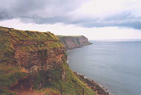
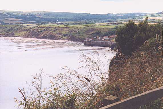
We continued our way to the finish. After reaching the North Sea the route follows the coast line for 2.5 miles (4 km). It is a beautiful ending of the Coast to Coast walk. By the time
we reached Robin Hood's Bay we saw a lot of familliar faces of fellow Coast to Coast Walkers. And together we dipped our shoes in the North Sea.
Next morning we made an early start and after some more walking in the moor, we descended into the woods. It is a pleasant, but sometimes slippery walk. By the time we left the woods it
started to rain a little. Again we were walking in the moor, which sometimes looked more like a swamp. Near Middle Rigg the route yoins a paved road, and we were glad about this, because the
rain was becoming heavier. At High Hawsker we sheltered in a bus stop and used our lunch while we were waiting for better times. And we were lucky. After about an hour, the rain stopped.
We continued our way to the finish. After reaching the North Sea the route follows the coast line for 2.5 miles (4 km). It is a beautiful ending of the Coast to Coast walk. By the time
we reached Robin Hood's Bay we saw a lot of familliar faces of fellow Coast to Coast Walkers. And together we dipped our shoes in the North Sea.
 |  | The end of our story | 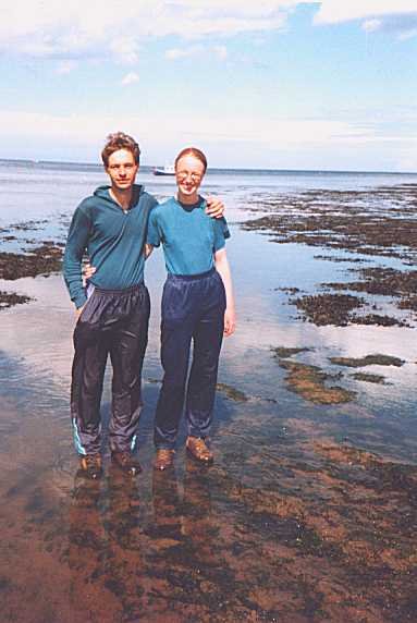 | 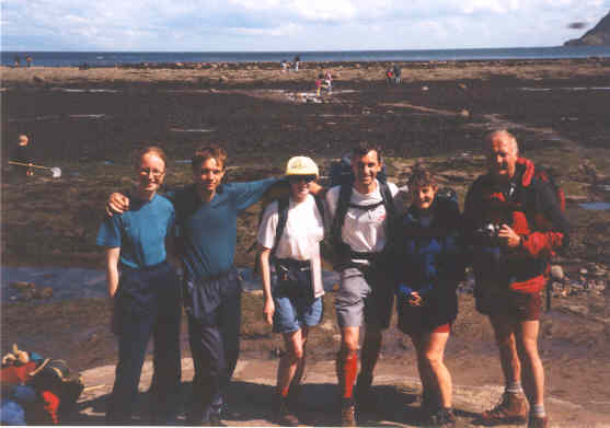 |
